Another 'Atmospheric River' Storm Renews Flood Threat In California

Emergency crews braced for the next bout of high winds and torrential rains forecast to sweep California starting on Wednesday, renewing the threat of power outages and flooding that struck parts of the state over the New Year's weekend.
The latest "atmospheric river" - an airborne current of dense moisture flowing from the ocean - was expected to drench much of California ahead of a Pacific storm front bringing additional showers to low-lying areas and more snow to the Sierra Nevada Mountains through Thursday.
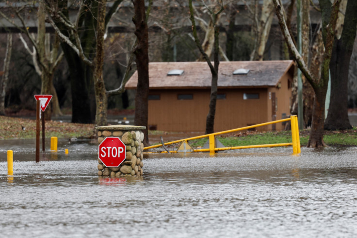
Authorities warned that heavy downpours would likely unleash flash flooding and mudslides, especially in areas where the ground remains saturated from rains that soaked northern California days earlier. Fire-ravaged hill slopes are also particularly vulnerable to slides.
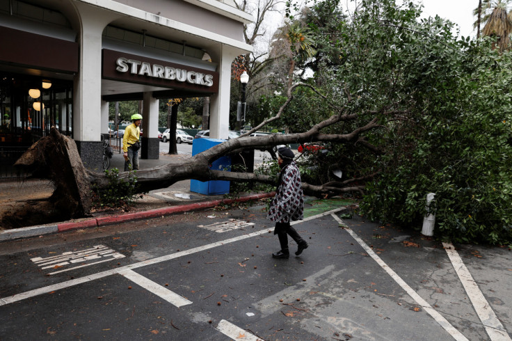
The National Weather Service also posted high-wind warnings across the San Francisco Bay area and central California coast, with gale-force gusts expected to knock down tree limbs and power lines, disrupting electricity service in many areas.
Showers fell across Southern California early in the day on Wednesday, slickening freeways during the morning Los Angeles-area commute, but rains were expected to reach peak intensity on Thursday morning.
Governor Gavin Newsom declared a state of emergency on Wednesday to support the state's winter weather hazards response, and activated California's flood operations center.
The governor's Office of Emergency Services said it had pre-positioned crews in three counties likely to be hardest hit by flooding - Marin, Butte and Sacramento - and in five counties facing heightened mudslide threats where previous wildfires have stripped hillsides of vegetation. But "burn scars" in other parts of the state were also at risk.
State Natural Resources Secretary Wade Crowfoot urged residents in high-risk areas to stay indoors unless they are ordered to evacuate, and to prepare for power outages by charging electrical devices and having flashlights and candles handy.
Sacramento County crews were still out on Wednesday repairing levee breaches along the Cosumnes River, near Sacramento, where flooding last weekend closed Highway 99, Crowfoot said at a news briefing in the state capital.
The latest round of extreme weather was the second in a series of potentially damaging storms expected to hit the state over the next seven to 10 days, Nancy Ward, director of emergency services, told reporters. The state operations center had been placed at its highest level, she said.
"We anticipate that this may be one of the most challenging and impactful series of storms to touch down in California in the last five years," she said.
While forecasts call for heavy rain and snow to taper off by late Thursday in California, coastal showers were likely to linger over the Pacific Northwest into Friday morning, according to the NWS.
Snow from the West Coast was expected to spread on Wednesday into the Great Basin, and extend into parts of the Southwest and central Rockies by Friday, the weather service said. A separate storm system hovering on Wednesday over parts of the Midwest was forecast to drift off the East Coast by Friday.

© Copyright Thomson Reuters 2024. All rights reserved.


