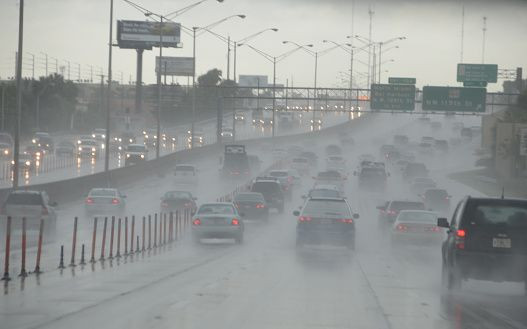
Depression In Gulf Coast: Heavy Rainfall Threatens Florida And Southeastern Parts

The National Hurricane Center on Sunday warned there was a chance of a subtropical or tropical system developing in the south-eastern Gulf, off the coast of the Florida panhandle, in the next few days. There is 20 percent chance for it to develop in the next two days and 40 percent chance in five days, the agency said.
On Sunday, a large area of disturbed weather — cloudiness, showers, and thunderstorms — stretched from western Cuba across the south eastern Gulf to the Florida Peninsula. Early indications suggested it could head towards the northern Gulf Coast by Wednesday night.
While the storm is not expected to develop anytime soon, it is likely to continue to drench south Florida over the next week and possibly into the coming weekend.
If surface low pressure becomes a well-defined circulation with enough convection nearby, this would be the first subtropical or tropical depression or storm of the 2018 Atlantic hurricane season, which doesn't officially begin until June 1. If it reached tropical storm strength, it would earn the name Alberto, reported Weather Underground.
The coverage of scattered storms and showers will increase Tuesday in the afternoon or evening hours. The heaviest rainfall of 3 to 5 inches or more is expected to remain well to the east over Florida.
"We expect only up to two inches of rainfall in South Mississippi over the next seven days. But, if that Gulf low moves just slightly more westward than expected, that could mean heavier rains for us," Mississippi-based ABC and CBS-affiliated television station WLOX's First Alert Meteorologist Wesley Williams.
According to John Purdy, a lead forecaster at the National Weather Service in Mobile told AL.com, the first impact will be rough surf along the beaches and an increase in the rip current risk.
"The second impact, depending on how much the low strengthens over time, would be some minor coastal flooding potential due to the higher swells working their way onshore," he said.
Rainfall is much needed in central and southern Florida, where drought conditions have recently developed. Although the rain is beneficial overall, there could be pockets of localized flash flooding in some districts.
“If the system impacts north Florida it could bring a lot of rain over the peninsula but also to southeast Alabama. There's the potential or some heavy rains, so we'll have to monitor the potential for some flash flooding depending on the speed of the system and how far west it goes,” Purdy added.
Chris Fisher, a meteorologist with National Weather Service in Miami told Miami Herald there is a lot of tropical moisture, and even though rain will be in the forecast every day, there will be some breaks.
"A lot of what we saw this weekend will continue for most of the week," he added.
"Regardless of subtropical or tropical cyclone formation, this system will enhance rainfall across portions of Florida and the north-eastern Gulf Coast during the next few days,” the tropical outlook memo warned the residents of south Florida.
© Copyright IBTimes 2024. All rights reserved.


