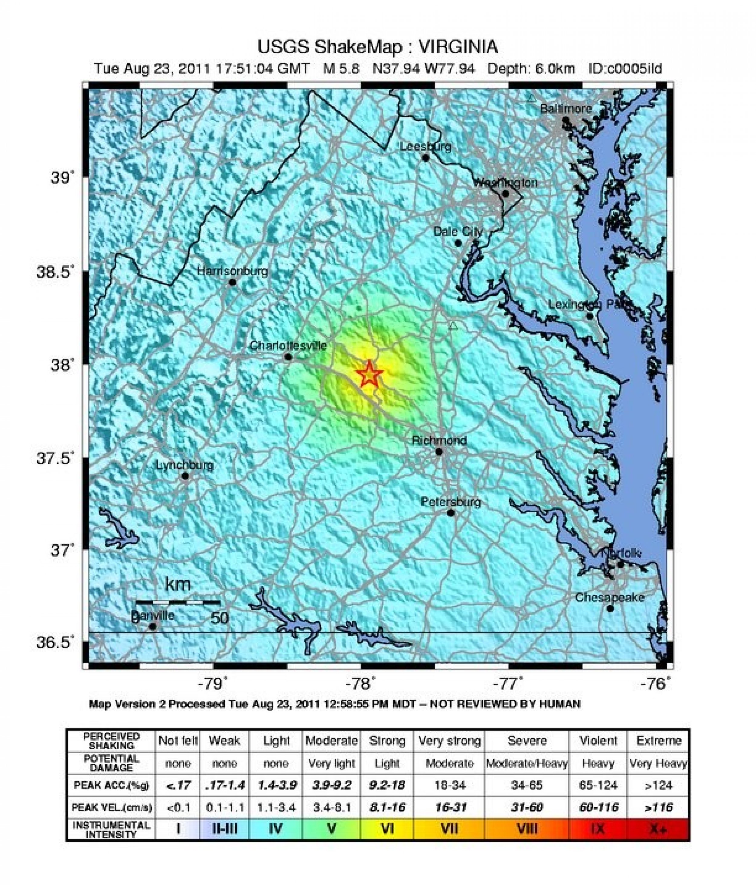
Earthquake 2011 Map: Where the Earthquake Hit [PHOTOS]
The tiny town of Mineral, Va., population 424, was the closest to the epicenter of the Virginia earthquake that reverberated across the East Coast, stretching from North Carolina to Toronto.
A 5.9-magnitude earthquake -- the most powerful to hit the metro Washington region since 1875 -- was reportedly three miles deep. Major buildings and landmarks including the White House, the FBI building and Capitol Building, had be evacuated. Two nuclear reactors were taken offline near Virginia as a precaution. There were no immediate reports of injuries.
While people on the West Coast are used to earthquakes, they can and do happen out East. They're just rarer out here and are typically felt over a much broader region. The Virginia quake sent tremors felt in cities including New York, Boston and Philadelphia, and many who felt it took to Twitter and Facebook to report the quake as soon as it happened.
According to the U.S. Geographical Survey, a 4.0 eastern U.S. earthquake typically can be felt at many places as far as 60 miles from where it occurred. As in this case, a magnitude 5.5 (or higher) eastern U.S. earthquake usually can be felt as far as 300 miles from where it occurred.
Here is a look at a few maps of the earthquake's epicenter were distributed by the U.S. Geographical Survey, check them out.


© Copyright IBTimes 2024. All rights reserved.


