Frankenstorm 2012: Hurricane Sandy Path Set To Blast East Coast During Halloween Weekend

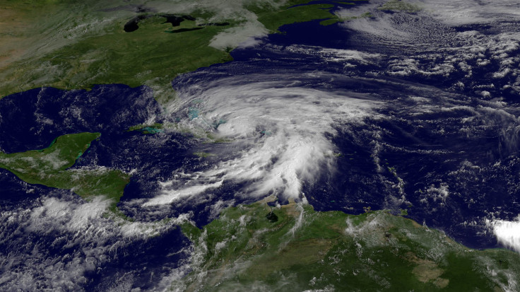
Now that Hurricane Sandy has made its rounds over Haiti, Jamaica and Cuba, It’s the East Coast’s turn to brace for the storm as a combination of weather conditions threaten to turn it into a disaster area as early as Monday.
While the National Hurricane Center in Miami is reporting that hurricane winds have died down Friday, it stresses that Sandy’s potential remains huge as it is predicted to join with a winter storm front, turning into a "Frankenstorm." The take on the perfect storm has taken on the thematic name since it is projected to reach over the Northeastern United States, right around Halloween.
Sandy has reportedly left at least 21 dead as it ground over Haiti, Jamaica and Cuba before weakening to a Category 1 hurricane late Thursday. As the NHC says that the hurricane could drop down to a tropical storm before rolling onto land in the United States, it warns the storm "could become a menace to the Northeast."
If the center proves to be correct, Sandy would roll in over an already elevated tide, increasing its storm surge. Northeastern officials are anticipating the storm that will reportedly carry enough power to knock over trees and power lines in a large region, all before joining a second weather system currently over land to form a monster storm.
Meteorologist Kathy Orr at CNN affiliate KYW-TV in Philadelphia warned viewers Thursday that Sandy could be a storm "of historic proportion" and that the City of Brotherly Love could take a direct hit.
"There is potential for widespread power outages, not just for a couple of days but for a couple of weeks or more, if the storm stays on track," she said.
The NHC reports that the weather system combo is projected to strike somewhere between Washington and Boston, affecting some of the most densely populated areas of the country.
According to CNN meteorologist Pedram Javaheri, there is a 90 percent chance it will hit the American Northeast, where $1 billion in damage could mount as it rolls inland, even affecting parts of the Midwest.
With a cloud field stretching over 1,600 miles, Sandy is massive, Javaheri said. That's about the distance from Memphis, Tennessee, to Los Angeles.
"Sandy should continue to expand in size," according to a National Weather Service advisory.
"From Sunday through Wednesday, winds of hurricane force are expected to lash exposed areas of the Northeast/Mid-Atlantic states, leading to potentially serious coastal erosion and coastal flooding," the weather service forecasts.
"This could be like the 'Perfect Storm' 21 years ago," CNN meteorologist Chad Meyers said of the potential damage.
Meyers is of course referring to a combination of three weather systems that produced the infamous "Perfect Storm" in the north Atlantic over Halloween 1991 when moisture flung north by Hurricane Grace combined with a high pressure system and a cold front, according to the weather service.
According to CNN, the current weather conditions are not duplicate circumstances of what produced the 1991 storm. And although Grace contributed significantly to the storm, it did not progress to New England and did not make landfall, weather records show.
© Copyright IBTimes 2024. All rights reserved.


