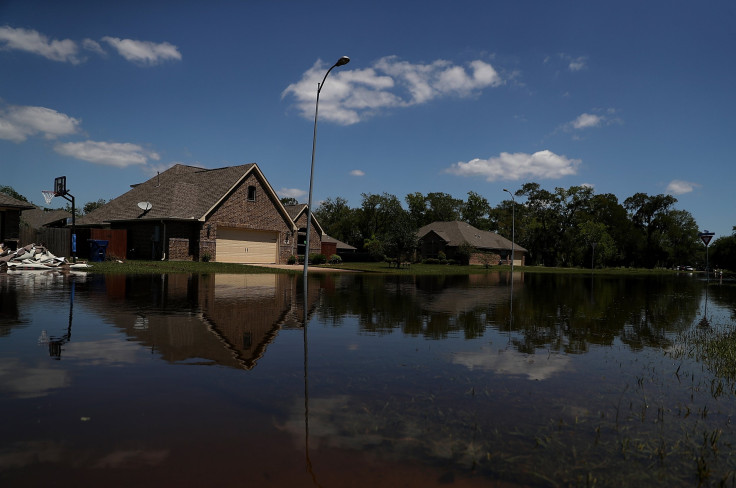
Houston, Texas, Weather Update: Hail, Flash Flood, Power Outages Prompt High-Water Rescues

After overnight storms from Tuesday to Wednesday morning dumped 10-12 inches of rainfall across different parts of Texas, a new spell of showers accompanied by hail washed over Houston and other adjacent regions Thursday, flooding the streets.
The National Weather Service (NWS) issued a flash flood warning for a number of areas in Texas such as Houston, Pasadena, The Woodlands, Baytown, Channelview and others. The warning was supposed to expire after midnight. Also, most of the roadways in Houston were under a flash flood watch from Thursday afternoon to Sunday.
A number of high-water rescues near Bingle and Hempstead and golf ball-sized hail were reported in Katy, the Houston Chronicle reported. Many social media enthusiasts took to Twitter to share photos of the hailstones:
Golf ball-sized hail reported in Onalaska, along Lake Livingston, by my mom. #houweather #houwx pic.twitter.com/EJzgMh2iW5
— rachaelgleason (@rachaelgleason) May 10, 2019
@TravisABC13 hail in #Highlands pic.twitter.com/1Q9YV4VRJR
— Lana J. Gaeke (@LJGaeke) May 10, 2019
There were also some unconfirmed reports of a tornado in Northeast Houston:
Just received unconfirmed report of a tornado in North East area of Houston.
— Chief Art Acevedo (@ArtAcevedo) May 10, 2019
Harris County meteorologist Jeff Lindner said three inches of rain had fallen in most areas of Houston. The Houston Fire Department pulled two people from a submerged car on Bunker Hill Road. Weather experts said some areas in Houston could expect over two to six inches of water as a result of flash flooding.
As a severe thunderstorm watch was issued for several counties, including Harris, Fort Bend, Montgomery, Waller and Liberty, a ground stop was ordered at Bush Intercontinental Airport, which was expected to continue past midnight.
Houston Mayor Sylvester Turner warned fans against attending Thursday’s baseball game of the Houston Astros versus the Texas Rangers.
"If you're not living fairly close to the stadium, this may be one of those evenings where you might want to reconsider," Turner said Thursday afternoon. "My concern would be getting home and the number of people that will be on the road getting home. Today is maybe a day to have a happy hour at home.”
Meanwhile, the NWS predicted the severe weather in the state to continue well into the next week.
“The Southern U.S. will continue to be fairly active through the medium range period as an upper level shortwave ejecting into the Southern Plains early next week interacts with pooling moisture along a nearly stationary frontal boundary along/just off the Gulf Coast. Widespread, potentially heavy, rainfall is likely initially across parts of the Southern High Plains Sunday into Monday (May 12-13), and spreading into central/southeast Texas and the lower Mississippi Valley by Tuesday-Wednesday (May 14-15),” it said.
As of 10:52 p.m. CDT (11:52 p.m. EDT) the CenterPoint Energy, the electricity provider in Houston and the adjacent areas of Texas, reported 88,510 customers were without power.
A number of school districts in the area, including Houston Independent School District, canceled after-school activities Thursday and other ceremonies and festivals that were lined up for Friday and the weekend. A complete list of the canceled events can be found here.
In addition, Mothers’ Day events [May 12] planned by the schools were also canceled. The George Ranch Historical Park in Richmond, Fort Bend County, remained closed as a result of flood and storm damage earlier this week.
© Copyright IBTimes 2024. All rights reserved.


