Hurricane Irene 2011 Track: Latest Warnings and Watches [MAPS]
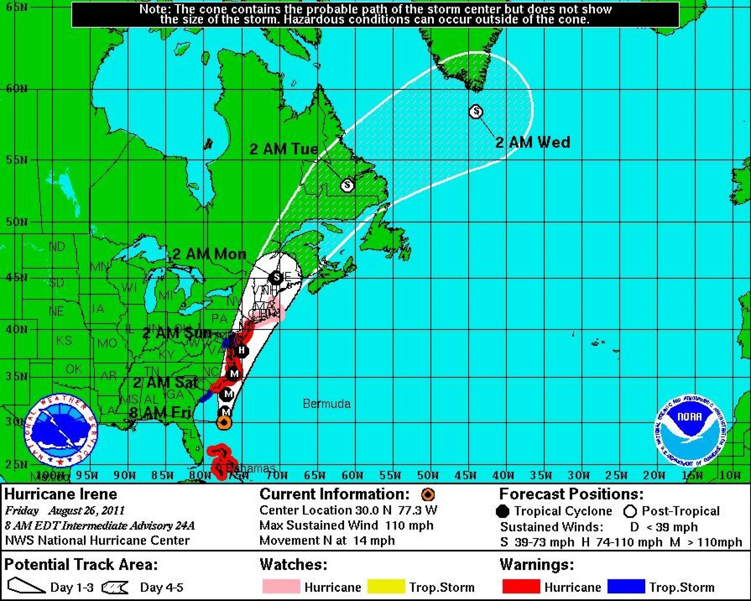
The entire U.S. East Coast from Charleston to Boston is under some sort of tropical watch or warning on Friday.
A hurricane warning is in effect for The Grand Bahamas and Abaco Islands as well as the entire Atlantic Coast of the U.S. from Little River Inlet, N.C. to Sandy Hook, N.J. This includes Palmico, Albemarle, and Currituck bays in North Carolina, as well as Delaware Bay and the Chesapeake Bay south of Smith Point.
A hurricane watch is in effect for North of Sandy Hook, N.J. through the Mouth of the Merrimack River, Mass. This includes New York City, Long Island, Block Island, Boston, Nantucket, and Martha's Vineyard.
President Baracl Obama, who is vacationing on Martha's Vineyard, is expected to make a statement on Friday urging Americans to heed evacuation orders ahead of Hurricane Irene.
A tropical storm warning is in effect for north of Edisto Beach, S.C. to the North Carolina border at Little River Inlet.
A tropical storm warning is also in effect for the Chesapeake Bay from Smith point northward and the tidal Potomac.
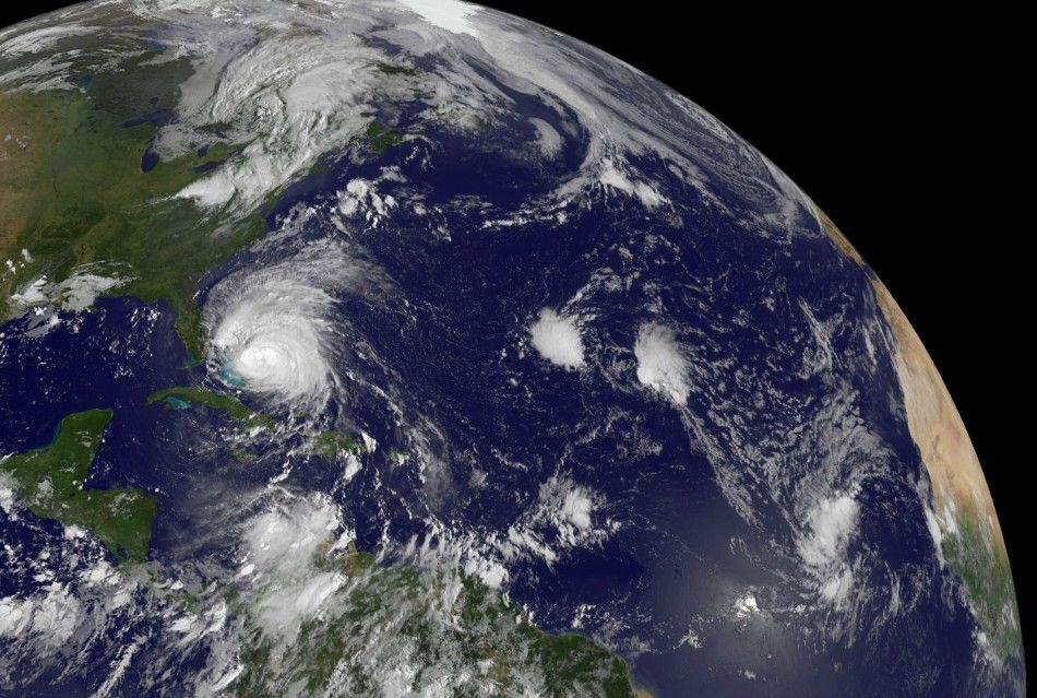
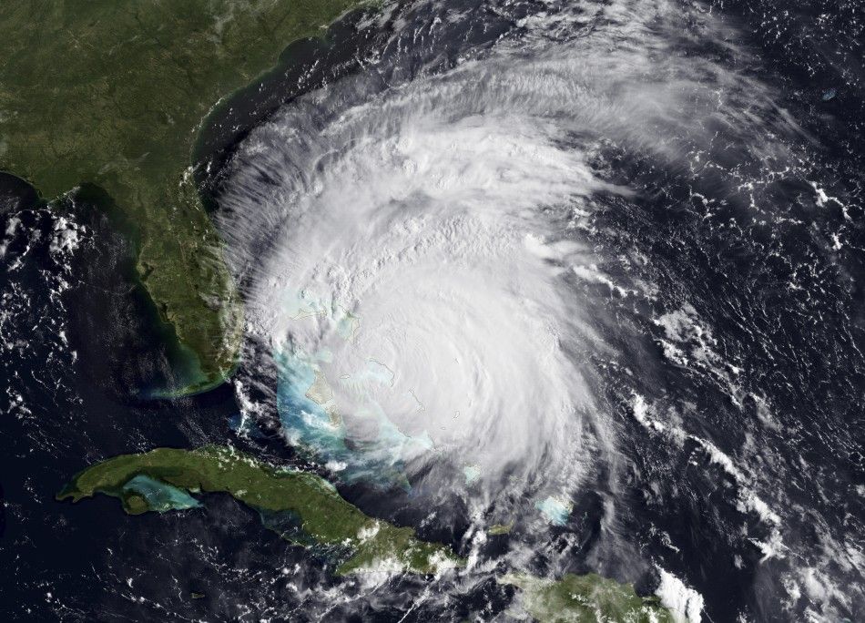
Hurricane Irene has grown into a massive storm with hurricane-force winds extending outward up to 90 miles from the storm center and tropical-storm-force winds extending outward up to 290 miles. This means that even if the center of the storm doesn't pass directly over your area, the effects will be felt far and wide.
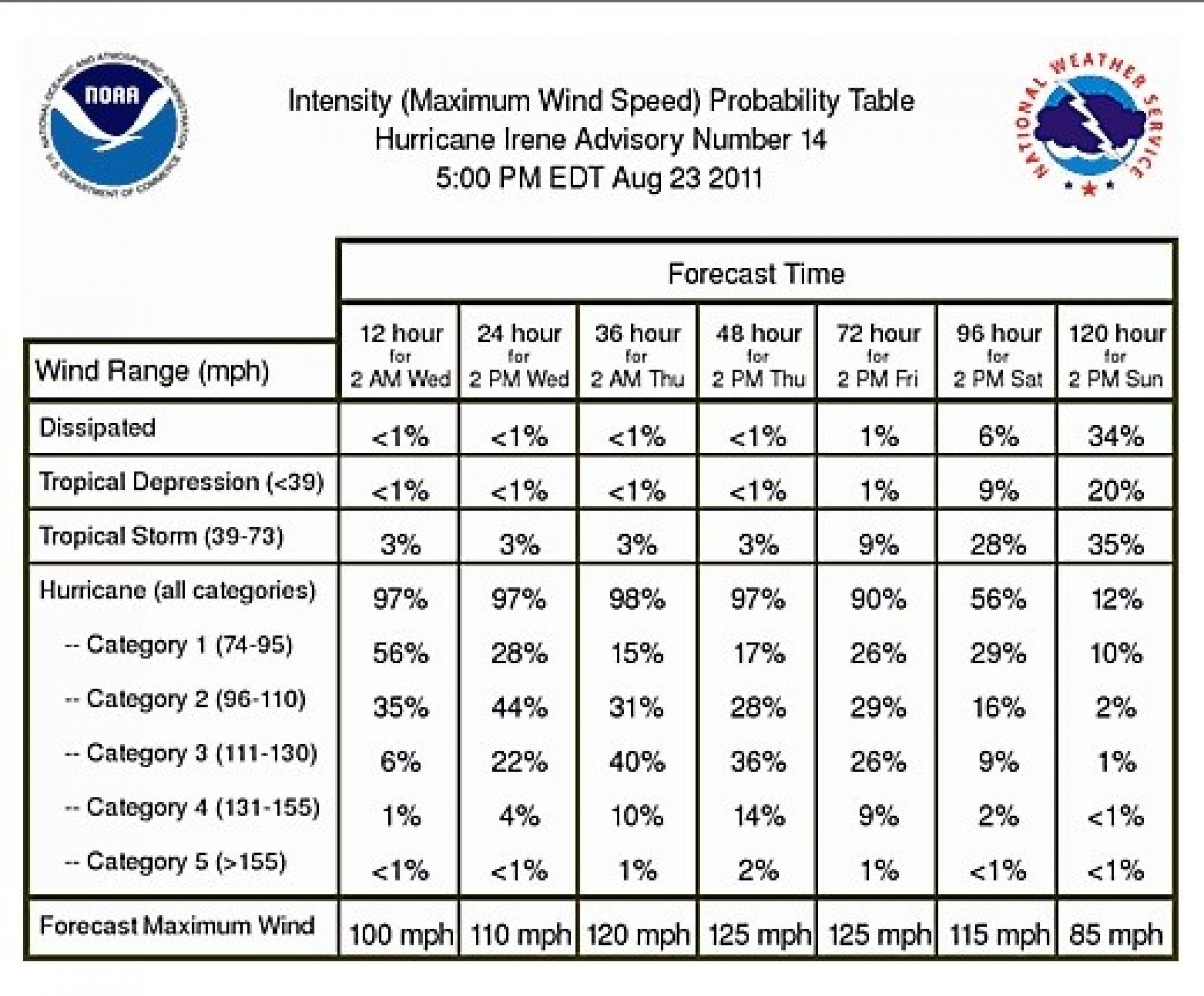
Irene has weakened to a Category 2 on the Saffir-Simpson Hurricane Wind Scale, with winds near 110 mph. She is moving north at 14 mph and is located about 375 miles south-southwest of Cape Hatteras, N.C.
With the expected arrival of a nearly 600-mile-wide hurricane, states across the east coast began preparations.
Five states have declared a state of emergency: North Carolina, Virginia, Maryland, New Jersey, and New York.
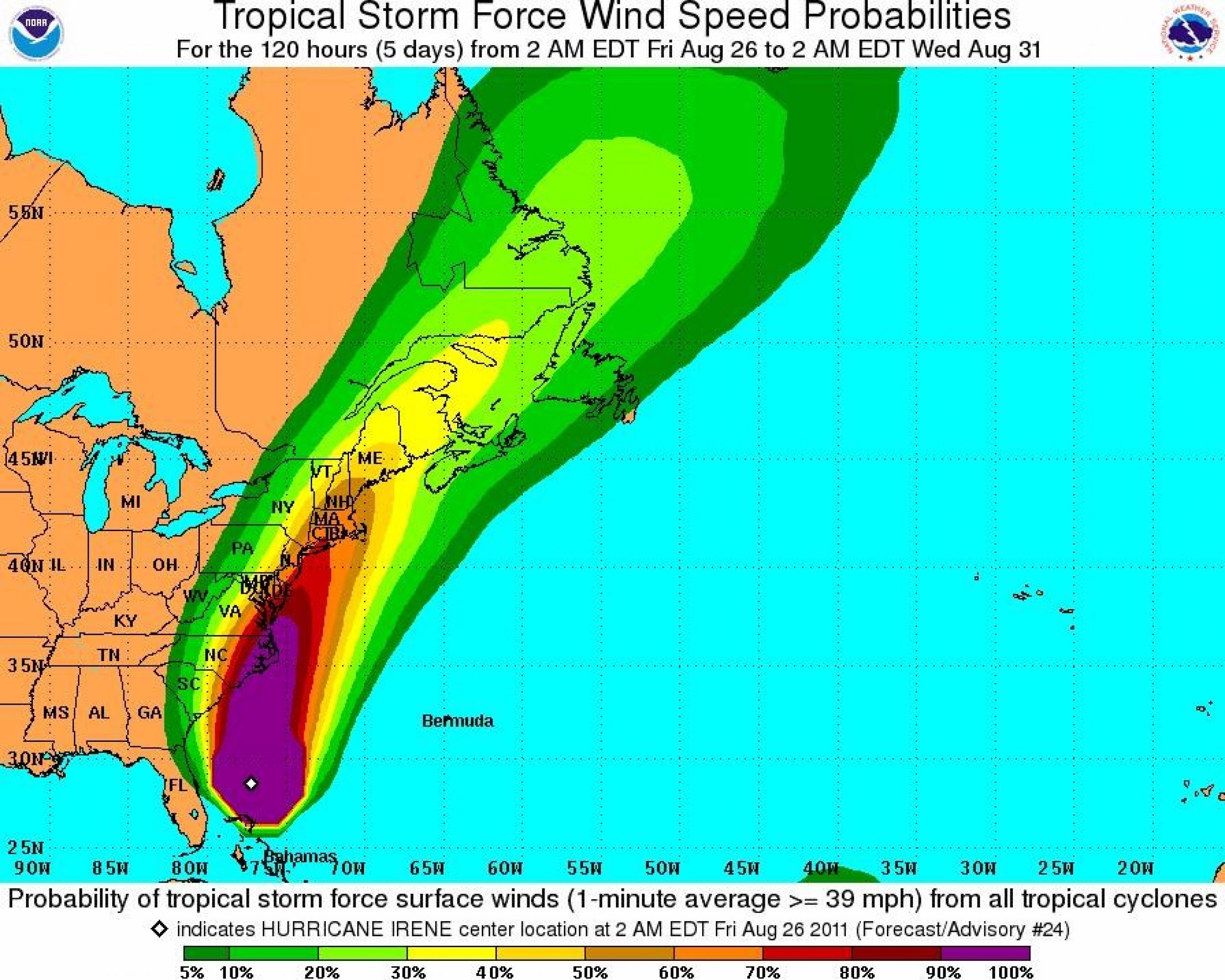
Have a look at the latest maps, warnings, and satellite photos below:

© Copyright IBTimes 2024. All rights reserved.


