Hurricane Irene 2011: Watches and Warnings from SC to ME [MAPS]
As of the 5:00 p.m. National Hurricane Center alert, the entire East Coast of the United States from Edisto Beach, South Carolina to the tip of Maine is under some form of watch or warning for Hurricane Irene.
The hurricane warning has been extended north from Sandy Hook, New Jersey to Sagamore Beach, Massachusetts. This now includes New York City, Long Island, Coastal Connecticut and Rhode Island, Bock Island, Martha's Vineyard, and Nantucket.
A tropical storm warning was issued north of Sagamore Beach to the mouth of the Merrimack River in Massachusetts.
A tropical storm watch was issued from the mouth of the Merrimack River up through Eastport, Maine.
These watches and warnings are in addition to those issued earlier in the day for the Carolinas, Virginia, Maryland, Delaware, and New Jersey.
Hurricane Irene has grown into a massive storm with hurricane-force winds extending outward up to 90 miles from the storm center and tropical-storm-force winds extending outward up to 290 miles. This means that even if the center of the storm doesn't pass directly over your area, the effects will be felt far and wide.
READ ALSO:
Over a Thousand Flight Cancellations as Airlines Prepare for Irene
Hurricane Irene New York City: How to Prepare for the Storm
How to Throw a Hurricane Party for Irene
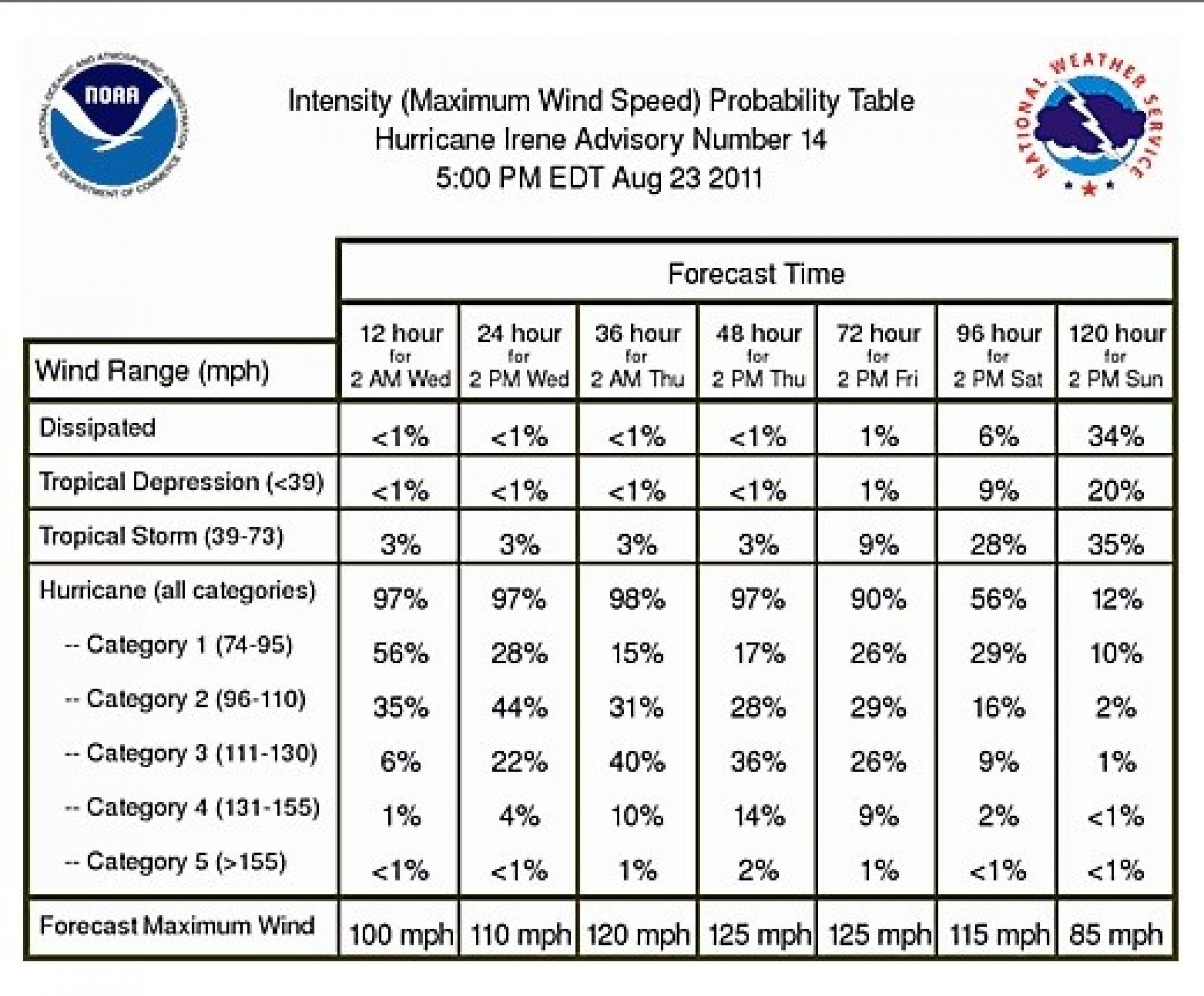
Irene has weakened to a Category 2 on the Saffir-Simpson Hurricane Wind Scale, with winds near 100 mph. She is moving north at 14 mph and is located about 265 miles south-southwest of Cape Hatteras, N.C.
Expecting the arrival of a nearly 600-mile-wide hurricane, states across the east coast began preparations. States up and down the Eastern Seaboard from North Carolina to Connecticut declared states of emergency to access federal funding and prepare for the impending storm.
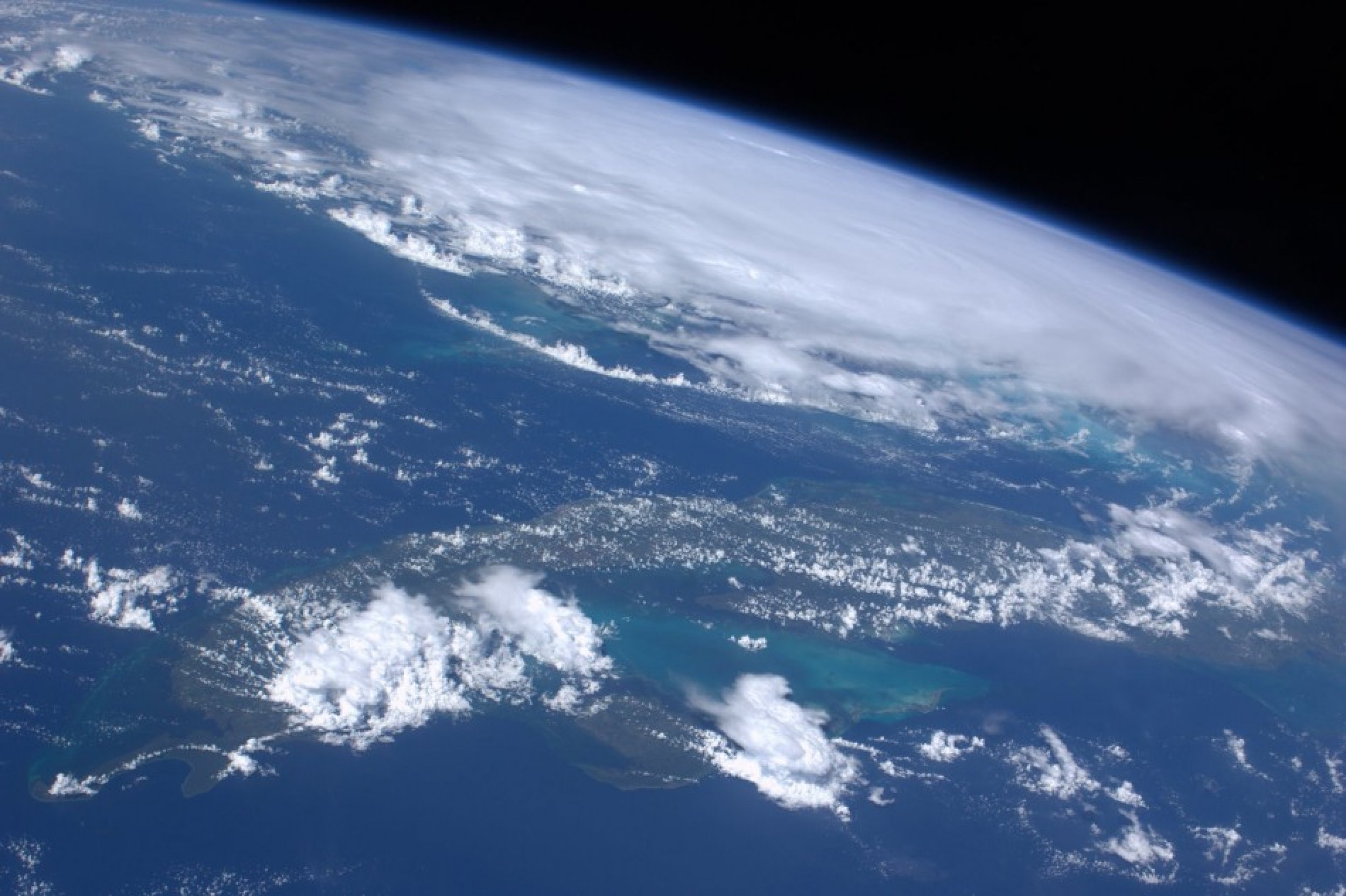
Here's a look at the latest maps, watches, warnings, and satellite images:


© Copyright IBTimes 2024. All rights reserved.


