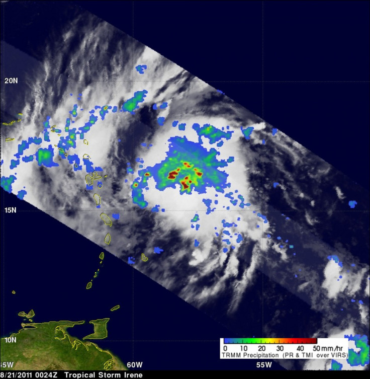
Hurricane Irene Heads for Carolinas; Could be Category 4 Storm

Officials in Florida and the Carolinas told their residents to begin making storm preparations in case Irene -- the first hurricane to seriously threaten the U.S. in three years -- makes landfall later this week after pummeling Puerto Rico.
Irene continued its path of destruction on Monday with winds reaching up to 100 mph as it headed towards the U.S. The Category 2 storm left one million Puerto Rican people without power on Monday, wreaked havoc in the Dominican Republic, destroyed Richard Branson's Virgin Island home, and appears on a direct path for North and South Carolina.
Initial estimates called for Irene to hit the south Florida area as a Category 3 storm, but new projections have it potentially hitting the Carolinas as a Category 4 storm. The storm is expected to sweep past Florida on Thursday and hit the Carolinas as early as Saturday.
The hurricane is expected to hit the Bahamas and Turks and Caicos on Tuesday and Wednesday, with wind speeds up to 120 mph.
According to The Weather Channel's projections, Irene will reach its peak of 135 mph, a Category 4, on Friday morning and continue up the coast as a Category 3 storm.
The last devestating hurricane to hit land in the U.S. was Hurricane Ike, which slammed Texas in 2008.
For residents in states that may be affected later this week, it's critical that you take this storm seriously, Craig Fugate, administrator at the Federal Emergency Management Agency, told the Associated Press.
Early estimates also have the Hurricane potentially going all the way up to New York by early next week, but the Northeast is only facing low to medium threats, according to The Weather Channel.
© Copyright IBTimes 2024. All rights reserved.


