Hurricane Irene Path: 5 States Declare Emergency [MAPS]
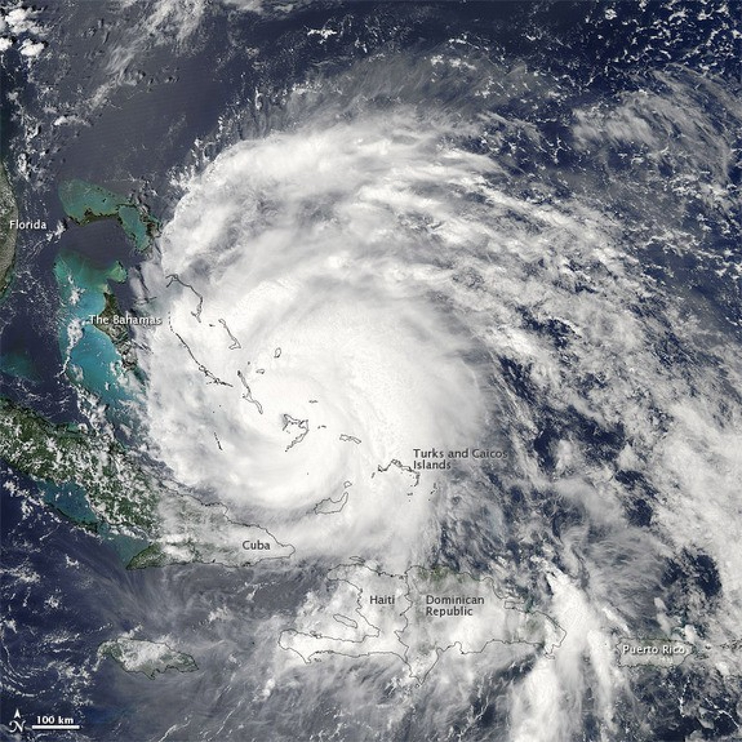
A strengthening Hurricane Irene continues to move towards the U.S. East Coast, destroying some islands in The Bahamas along its path as it heads for the big cities.
New York is the latest of five states to declare a state of emergency.
On Thursday, New York Gov. Andrew Cuomo followed the lead of heads of state of Virginia, New Jersey, Maryland and North Carolina.
North Carolina is projected to feel the brunt of Irene before all the others, as the storm is expected to make landfall there on Saturday.
Evacuations
Tourists already began evacuating Ocracoke Island, just off the coast of North Carolina, ahead of Hurricane Irene.
Gov. Beverly Perdue on Wednesday said residents will be asked to leave their homes on Thursday morning ahead of the Category 3 hurricane.
It's a standard precaution, Perdue has said. We want folks [in eastern North Carolina] to take this storm seriously and to get prepared.
Ocracoke is accessible only by boat and can carry no more than 50 cars at a time. About 800 residents call Ocracoke home all year round and the tourist population can grow into the thousands.
Currently Irene is a destructive Category 3 hurricane with winds of 115 mph. The storm is centered about 575 miles south of Cape Hatteras, N.C., and moving north-northwest at 14 mph.
With a state of emergency declared, these states now can freely allocate money toward resources and emergency personnel without the bureaucracy involved.
That a state of emergency is declared can also be an indication authorities believe the storm can be damaging or even deadly.
The storm is expected to deliver heavy rain and winds of up to 100 mph when it reaches New Jersey on Saturday afternoon. The storm is expected to deliver at least five to 10 inches of rain and could cause major flooding, according to Bill Read, the director of the National Hurricane Center.
New York City Mayor Michael Bloomberg warned of possible evacuations, but that recent forecasts didn't have the storm directly hitting the city. The most at risk areas within the city are Battery Park City in Manhattan, Coney Island in Brooklyn, South Beach, Midland Beach, and low-lying areas of Staten Island.
Long Island could be hit the hardest.
It looks like Long Island will be impacted in some way by this system, whether it's a hurricane or not when it gets here, said meteorologist Brian Ciemnecki of the National Weather Service to Newsday.
The last hurricane to hit the area was Hurricane Gloria in 1985. Only five hurricanes have come within 75 miles of New York City, according to weather data dating to 1851.
Potential Hurricane Damage
Kinetic Analysis Corp. estimates that Irene has caused $3.1 billion in damage in the Caribbean already. It's the area of impact that could most factor into the amount of economic damage even though the storm' strength is important.
It really depends on where it makes landfall, Chris Hackett, the director for Personal Line Policy for the Property Casualty Insurers Association of America, told the IBTimes. If it makes landfall right in Miami where there are a lot of high-rise condominiums the damage will be a lot more expensive than if it hits a rural area in Georgia or in the Carolinas.

© Copyright IBTimes 2024. All rights reserved.


