Hurricane Irene Path: Major Storm to Race up the East Coast [MAPS]
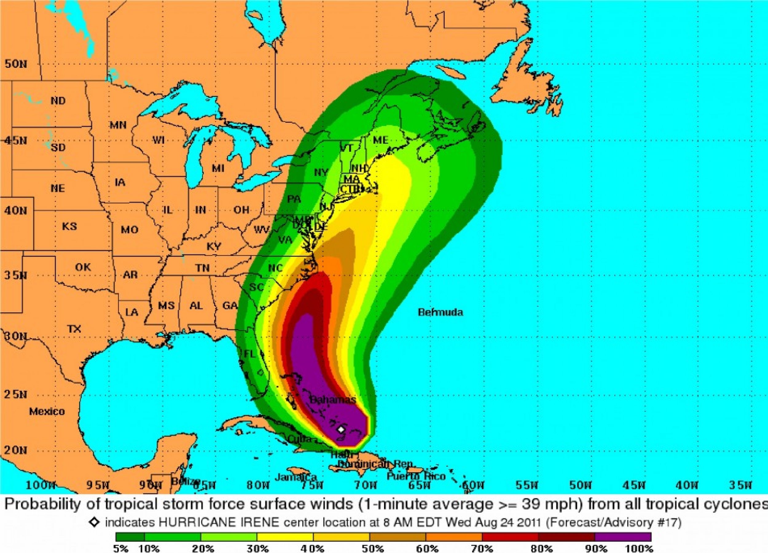
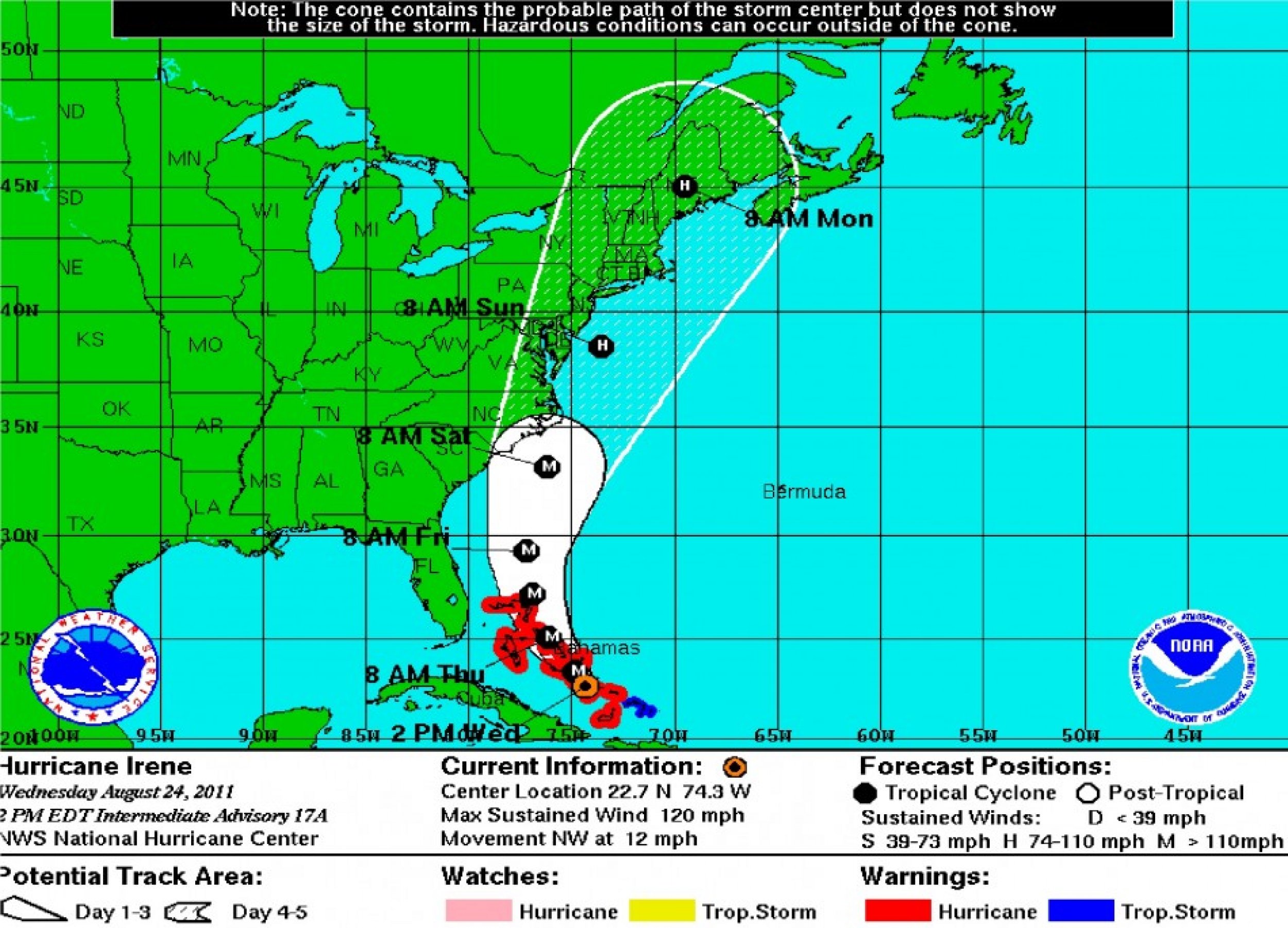
The latest predictions from the National Hurricane Center show Hurricane Irene cutting a path through the North Carolina coast before ripping up the Eastern Seaboard towards Long Island, New York and the New England States.
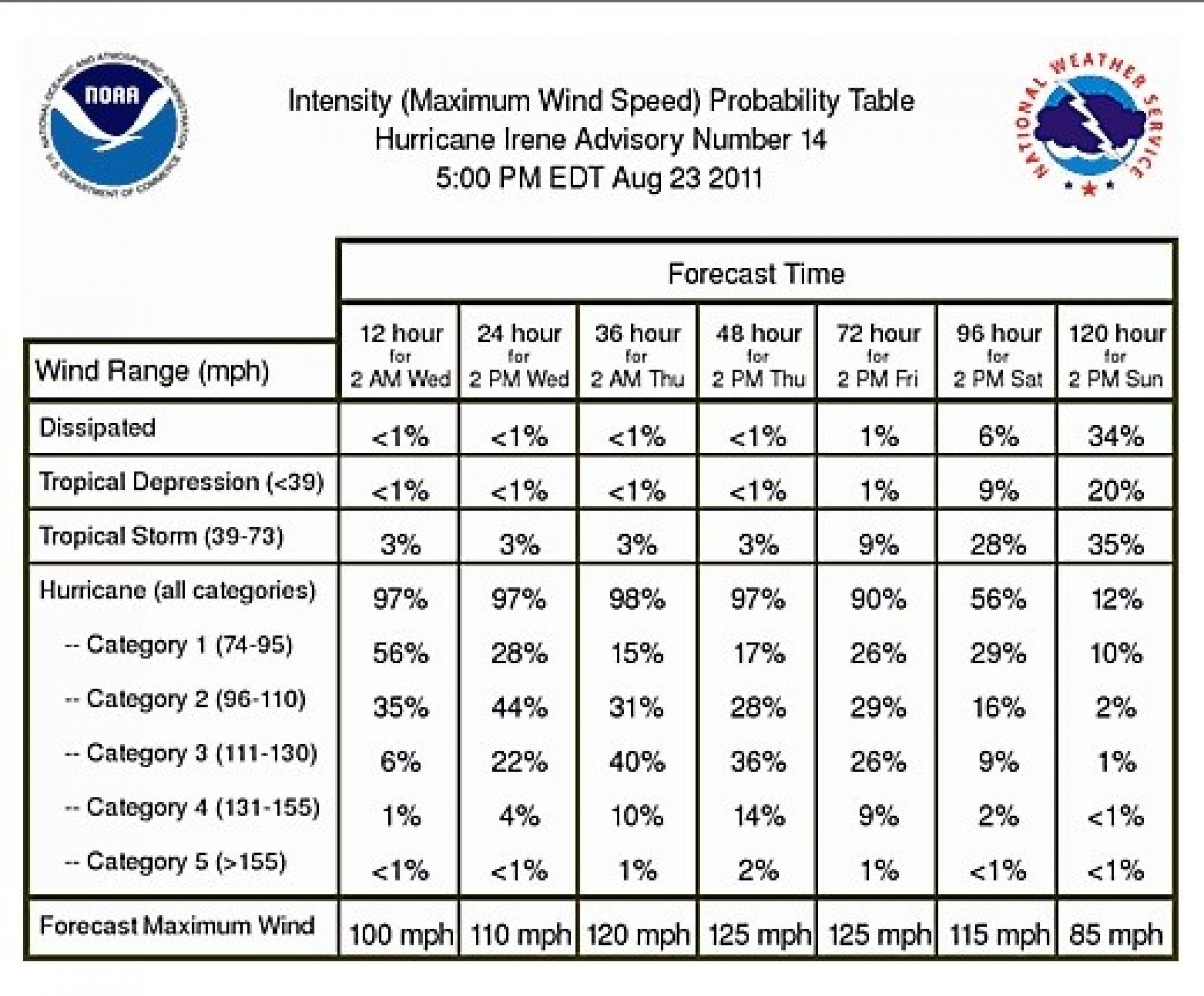
Irene became a Category 3 storm midday Wednesday as wind speeds continued to climb, making Irene capable of devastating damage, according to the Saffir-Simpson Hurricane Wind Scale.
The storm continued to batter the Bahamas Wednesday evening, with wind speeds up to 120 mph. While no deaths have been reported, the prime minister of the Bahamas, Hubert Ingraham confirmed that there has been extensive damage on the sparsely populated Mayaguana and Cat Islands of the lower Bahamas.
While Nassau should be spared from the brunt of the storm, tropical-storm-force winds were expected by 10:00 p.m. local time on Wednesday as the storm races through the central Bahamas on its way to the northern Bahamas Thursday morning.
As U.S. residents on the Eastern Seaboard keep a watchful eye on the storm, Craig Fugate, administrator of the Federal Emergency Management Agency, said Tuesday that the entire East Coast should be on alert.
Meteorologists at the National Hurricane Center predict that Irene will strengthen during the night Wednesday and become a Category 4 storm by Thursday morning. Officials up and down the East Coast were preparing for what could be the first major storm to hit the U.S. in three years.
The storm got very well organized as she passed farther away from the big island of Hispaniola, said Bill Read, who heads the National Oceanic and Atmospheric Administration's National Hurricane Center in Miami, during a briefing on Wednesday.
The effects of the hurricane in the form of tropical-storm, maybe even hurricane-force winds, rain, beach erosion, and tidal surge will be in play from the mid-Atlantic all the way up through New England as the storm progresses, he added.
READ ALSO: Hurricane Irene: What were the Worst Hurricanes to Hit New England?
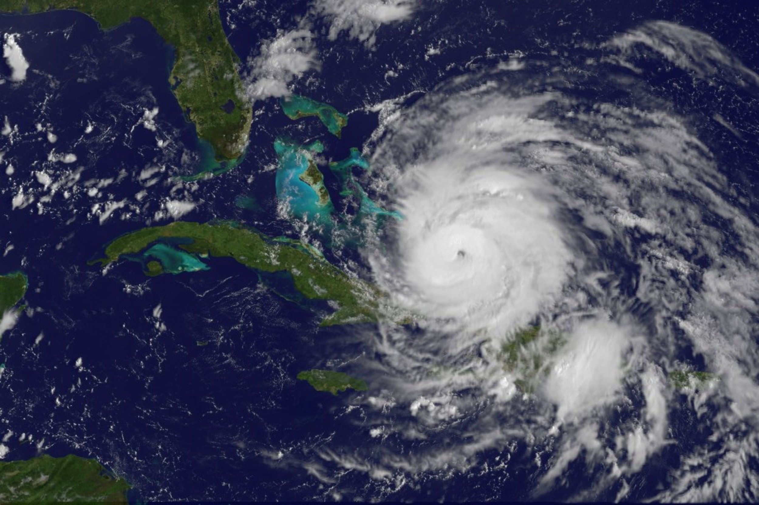
As of 8:00 p.m. EDT, the storm center was located 185 miles southeast of Nassau, Bahamas, or about 810 miles south of Cape Hatteras, North Carolina, moving northwest at 12 mph.
Hurricane-force winds now extend outward up to 60 miles from the storm center with tropical-storm-force winds extending up to 230 miles. That makes Irene slightly larger than earlier Wednesday.
A hurricane warning remains in effect for all of the Bahamas, while the National Hurricane Center made a broad warning to residents from the Carolinas northward to New England to monitor the progress of the storm.
Thousands of people in Ocracoke Island and other coastal regions of North Carolina were ordered to evacuate Wednesday in preparations for the storm.
According to the latest computer forecast models, there are three likely outcomes of the storm:
1.) Irene takes a more interior track, passing near Raleigh, N.C., Richmond, Va., Washington D.C., Baltimore, Md., Philadelphia and New York City. This is by far the worst-case scenario.
2.) Irene skirts the Outer Banks as a monster storm and makes landfall anywhere from the Jersey Shore to New England. Most agree this is the most likely scenario. In this case, Long Island, New York would be the most likely landfall location.
3.) Irene revs up and continues to shift eastward, missing the coast entirely like Hurricane Earl did last year. Unfortunately, this is unlikely. Unlike last year, there is a strong westward shift of the persistent steering pattern known as the Bermuda high that's more likely to push storms westward toward land.
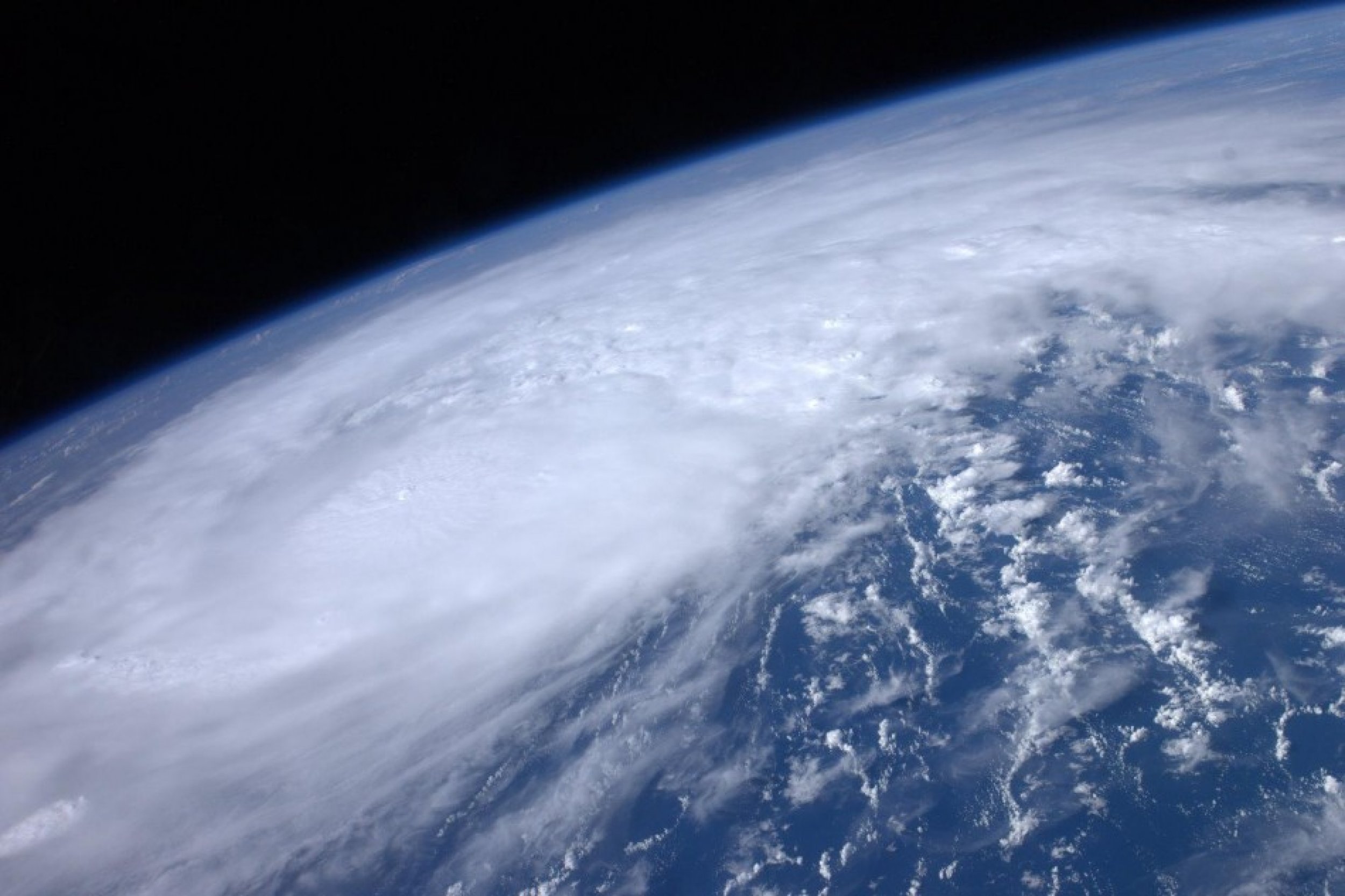
Take a look at the maps from the National Hurricane Center below:
© Copyright IBTimes 2024. All rights reserved.


