Hurricane Irene Projected Path [LOCATIONS & WIND SPEEDS]
Hurricane Irene's projected path is expected impact almost the entire East Coast.
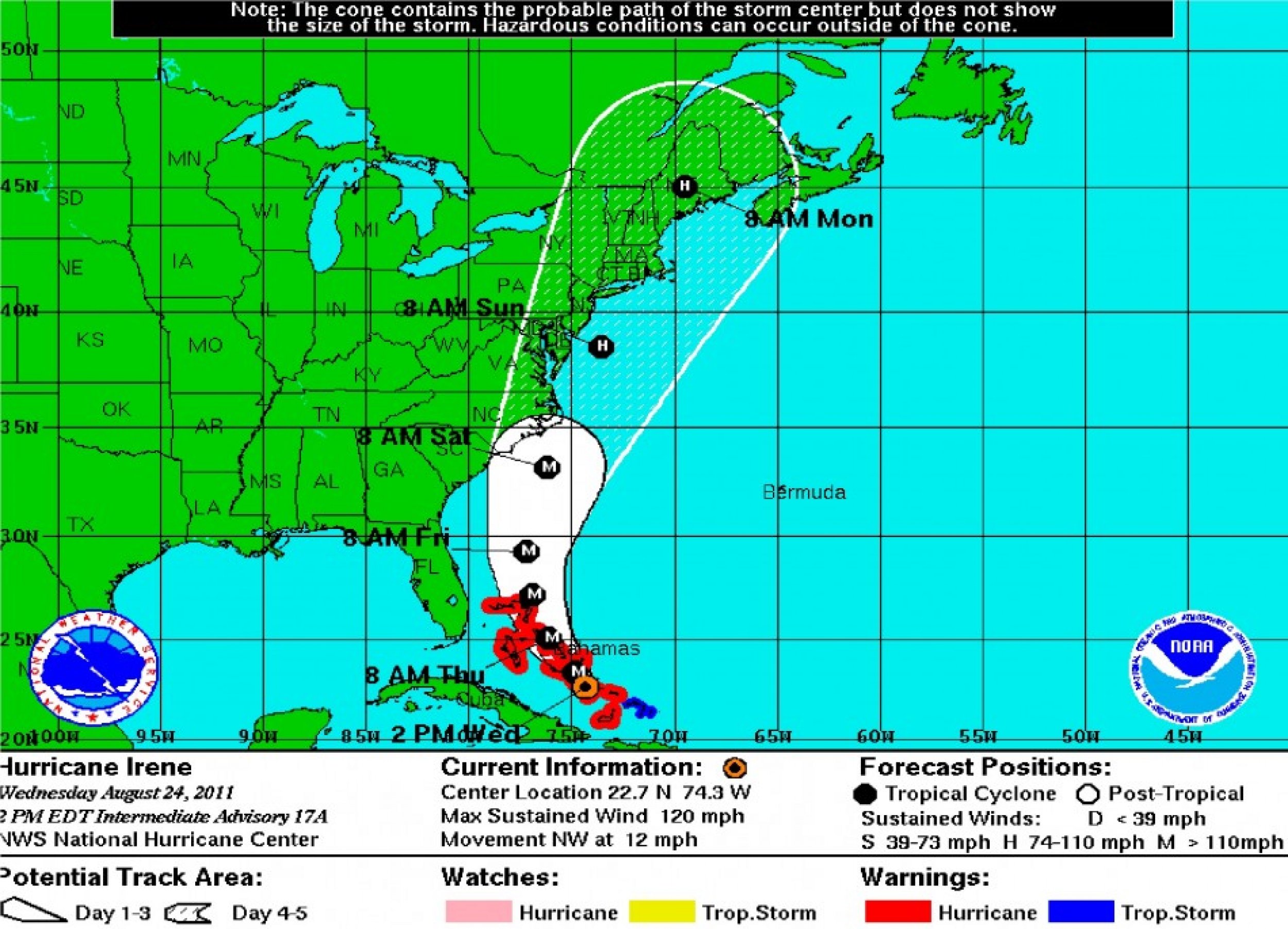
As of Wednesday, two p.m. EST, the U.S. National Hurricane Center (NHC) puts Hurricane Irene's max sustained wind speed at 120 mph, headed North West from the south tip of Cuba.
Map 1
Map 1 shows Hurricane Irene's projected path is expected to take the storm over much of inland East Coast, stretching from South Carolina to Canada; it's expected to engulf the entire state of Vermont, New Hampshire, Massachusetts, New Jersey, and about half of New York and Pennsylvania.
Map 1 also shows the expected timetable of Hurricane Irene's projected path, which is expected to hit the middle of the Bahamas by Thursday eight a.m., central Florida by Friday eight a.m., South Carolina by Saturday eight a.m., New Jersey by Sunday eight a.m., and Maine by Monday eight a.m.
However, this map doesn't show the intensity of the winds with respect to locations.
Map 2
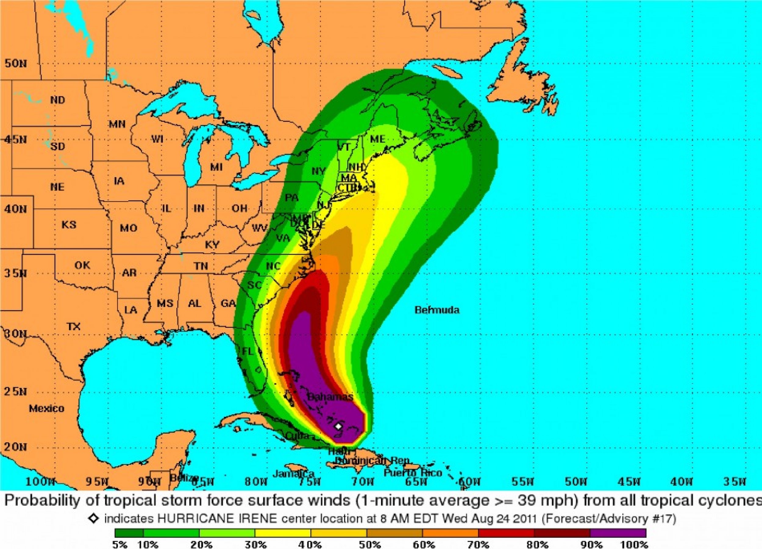
This map shows the probability that surface winds greater than 39 mph will strike certain locations.
Areas covered by green (spanning inland from the coast of Florida to Canada) will have a 0 to 10 percent probability of being hit. Areas covered by purple, like the Bahamas, have close to 100 percent chance of being hit.
The legend at the bottom of the map explains the percentages of the various colors.
Map 3
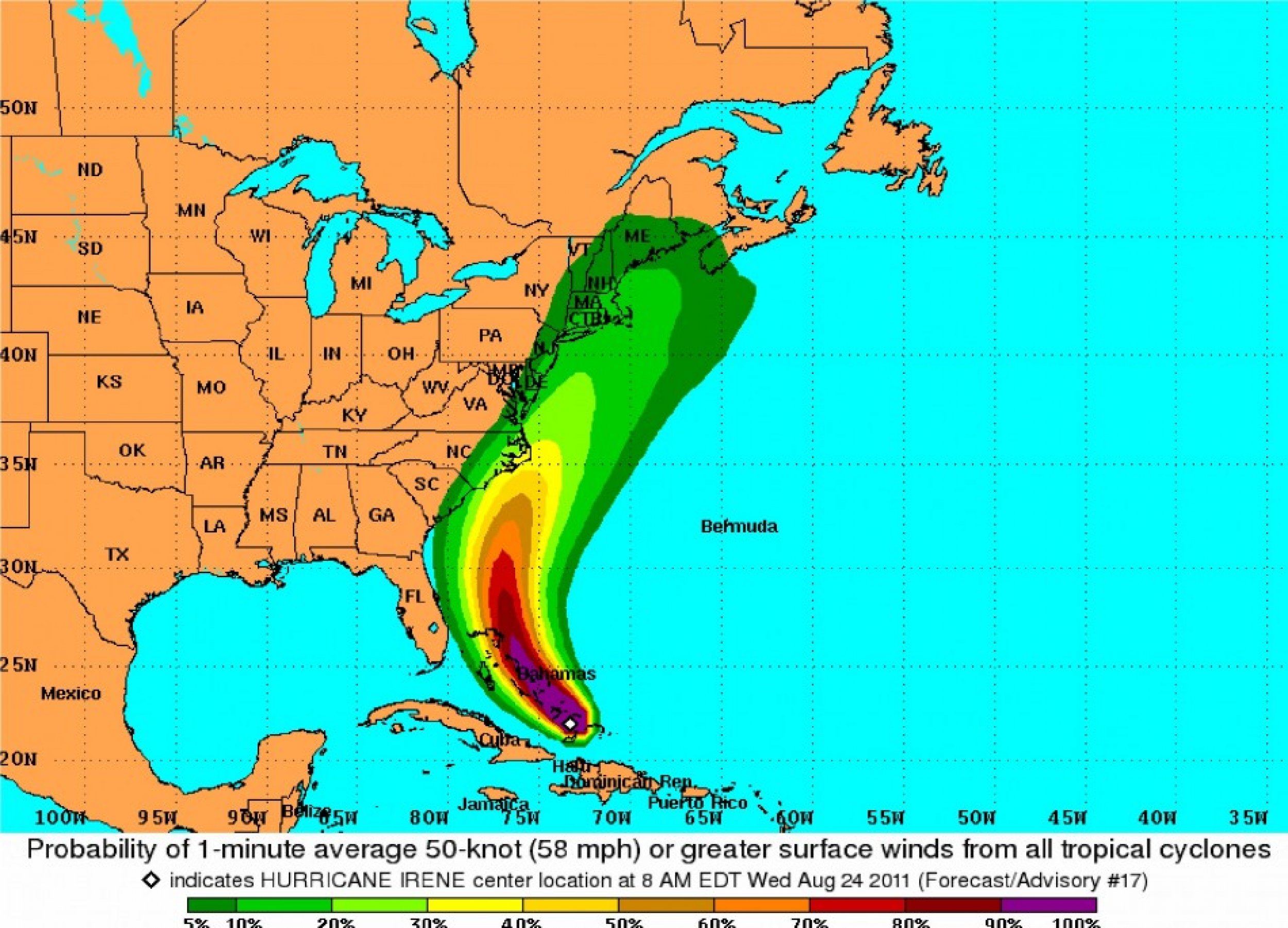
Same as map 2, but shows probability of winds greater than 58 mph hitting a location.
Map 4
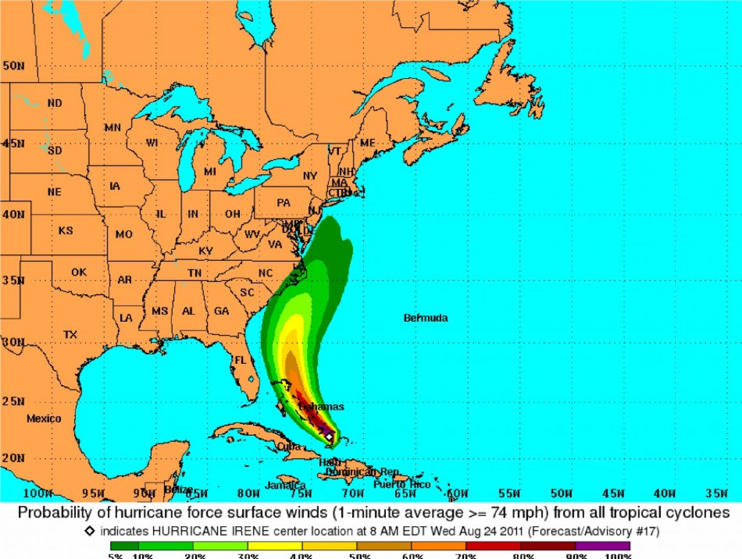
Same as map 2, but shows probability of hurricane force winds, which is defined as those greater than 74 mph.


© Copyright IBTimes 2024. All rights reserved.


