Hurricane Irene's Path: Major Storm Headed for the Carolinas [MAPS]
An ever-strengthening Hurricane Irene is expected to skim Southeast Florida early Friday morning as it barrels up the coast on its path toward the Carolinas.
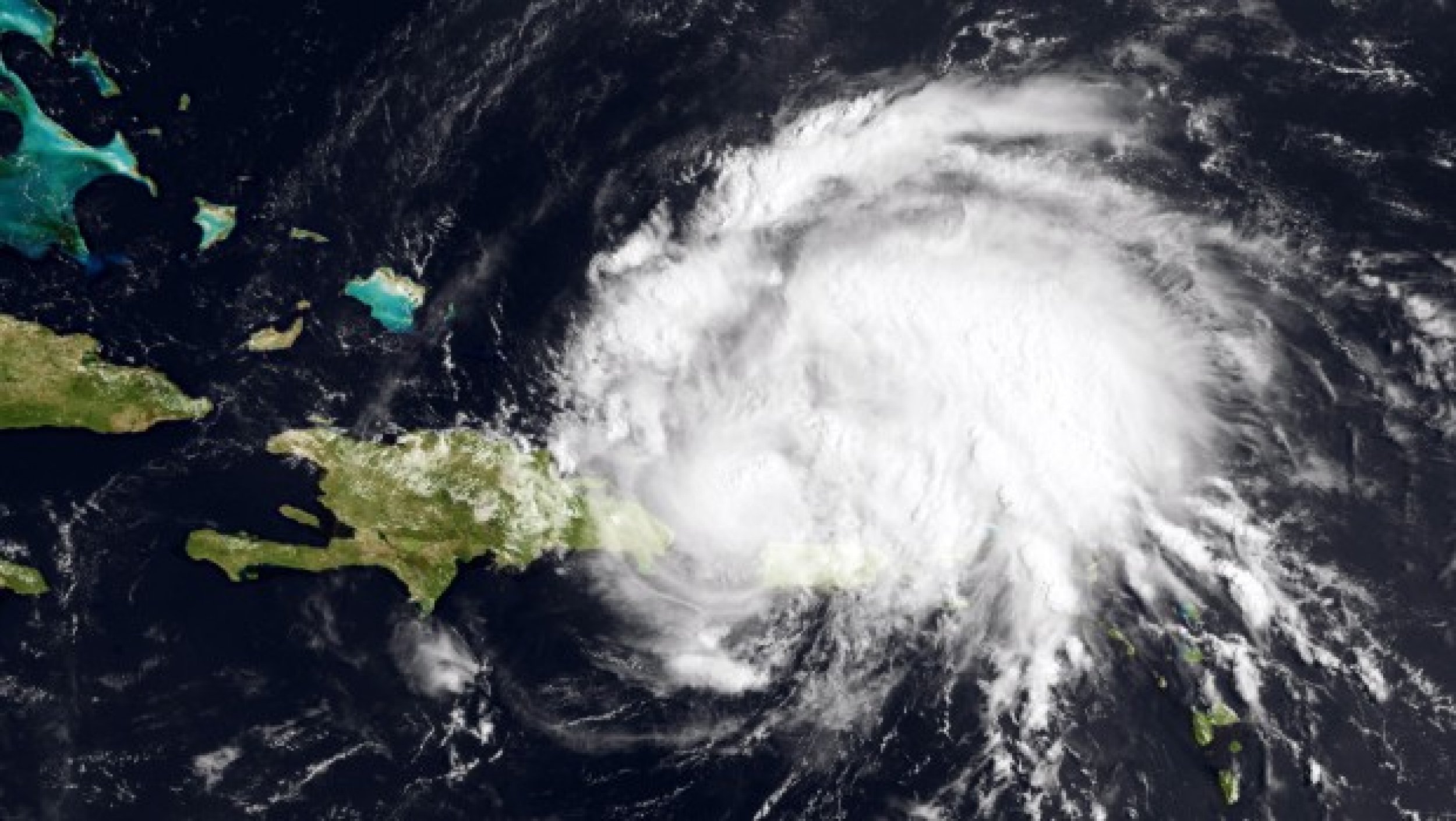
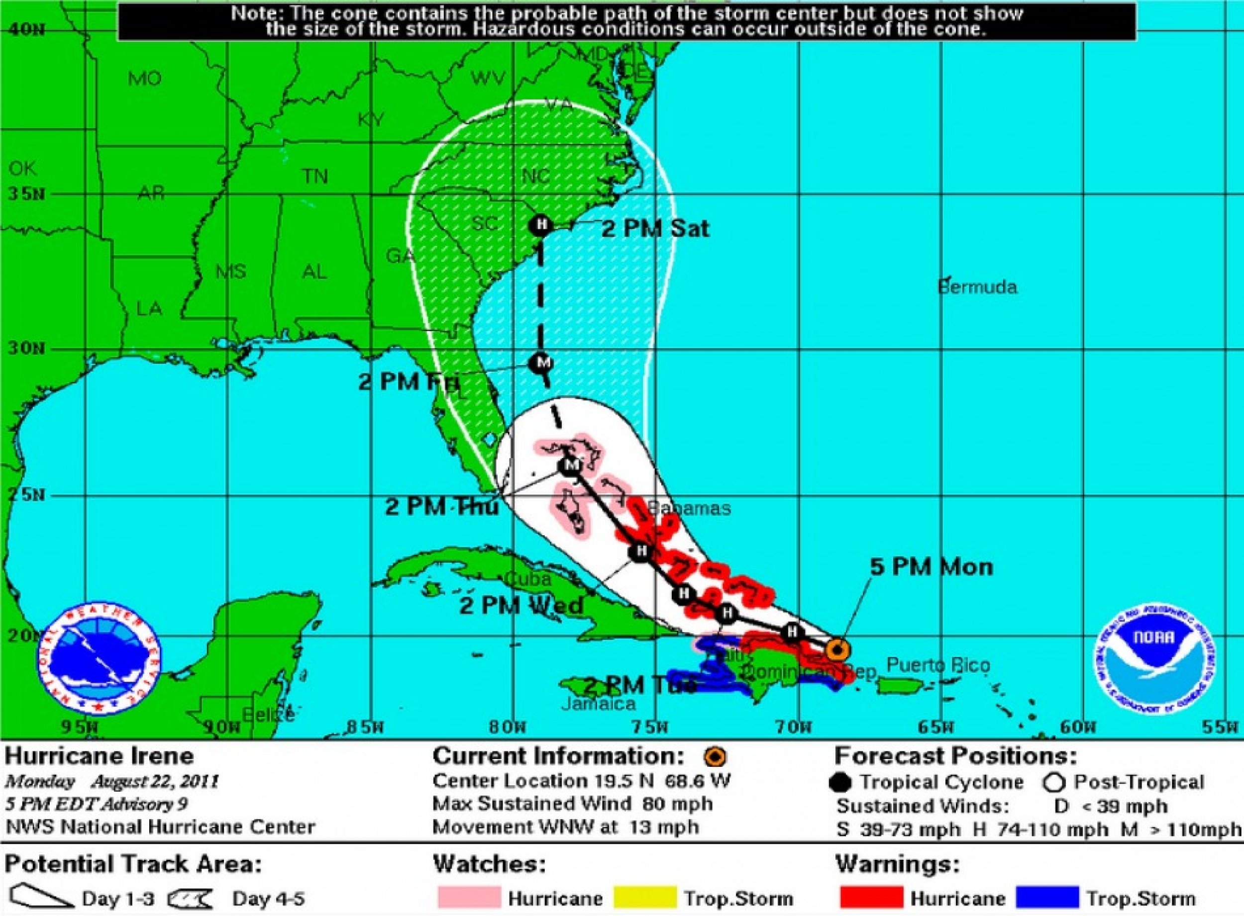
At eight a.m. EDT, the National Hurricane Center reported that Irene had sustained winds of 100 mph as it whipped the northern coast of Hispaniola. The storm center is now located 55 miles north of Puerto Plata, Dominican Republic and 70 miles south-southeast of Grand Turk Island.
A hurricane warning remains in effect for the north coast of the Dominican Republic, the Turks and Caicos Islands, and southeastern and central Bahamas.
A hurricane watch is in effect for the north coast of Haiti and northwestern Bahamas.
A tropical storm warning is in effect for the south coast of the Dominican Republic and all of Haiti.
The storm is moving west-northwest, but is expected to take a turn to the northwest early on Wednesday. This will drive it near or over the Turks and Caicos Islands and the southeast Bahamas on Tuesday and near or over the central Bahamas early Wednesday.
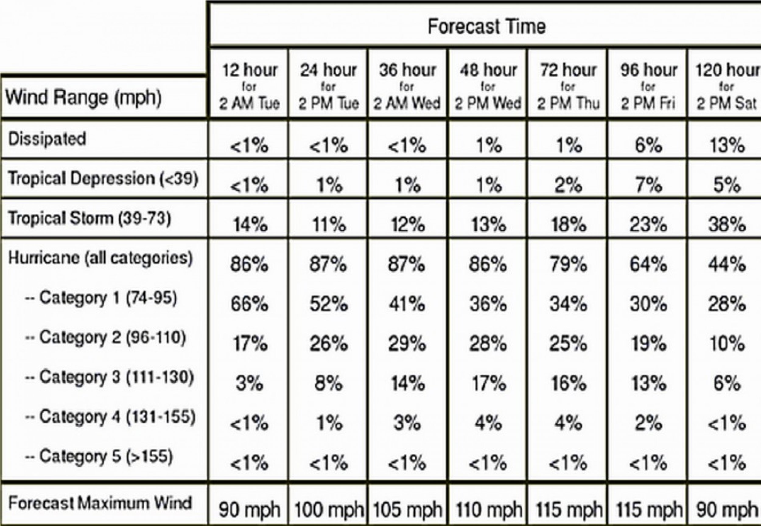
While Hurricane Irene is a Category 2 storm on the Saffir-Simpson Scale, additional strengthening is forecast during the next 48 hours, and Irene could become a major hurricane by late Tuesday or early Wednesday.
Irene has become a much larger storm with hurricane-force winds extending outward some 50 miles from the center and tropical-storm-force winds extending outward some 205 miles.
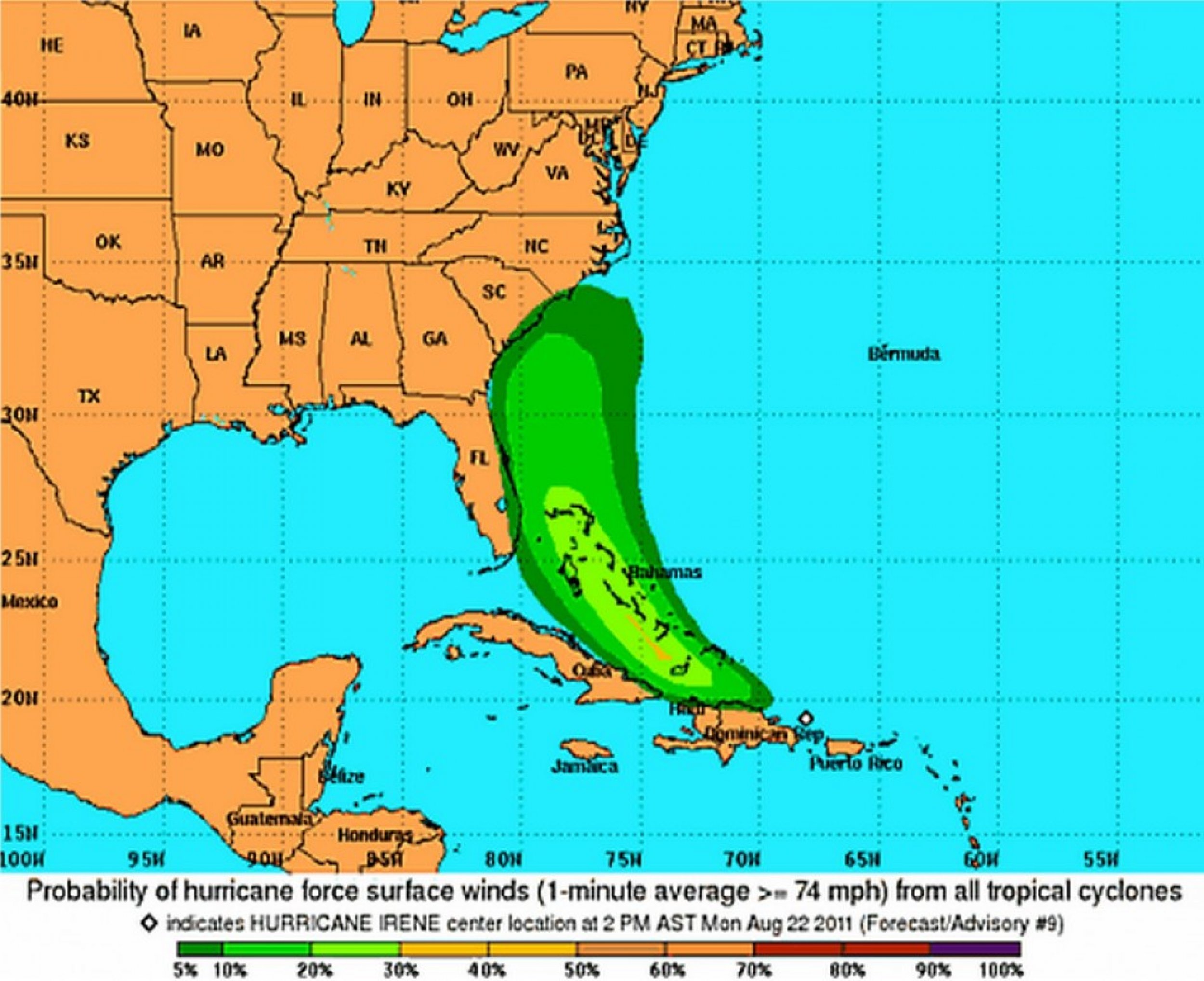
If the current projections hold true, Irene is expected to hit the mainland U.S. sometime late Saturday near the South Carolina and North Carolina border, possibly as a Category 4 hurricane.
On Monday, Irene eased away from the northwestern Caribbean, leaving nearly one million people in the dark in Puerto Rico, a billionaire's mansion torched by lightning in the British Virgin Islands, and fears of flooding across Hispaniola.
Have a look at the maps below:


© Copyright IBTimes 2024. All rights reserved.


