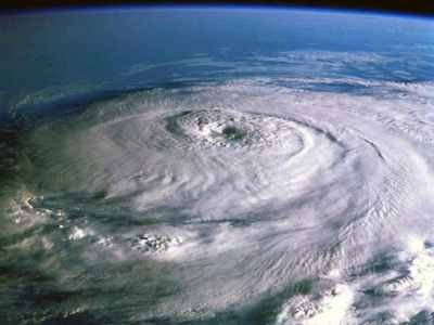
Hurricane Katia Path 2011: East Cost Could Feel Impact

Hurricane Katia 2011 is growing stronger, and while the storm's path still leaves unaswered questions, some along the U.S. East Coast from Florida to the Carolinas could feel its impact before it's all over with late next week.
At 11 a.m. Monday Katia was a Category 2 hurricane, with maximum sustained winds of 110 miles per hour. Katia could beome a major hurricane by Tuesday, forecasters said, with winds of 111 miles per hour or greater. The storm is expected to coninue moving in a northwest direction through Tuesday.
On Monday, forecast models weren't showing high odds of a direct U.S. strike, but forecasters say how the storm interacts with weakening Tropical Storm Lee, currently in Mississippi, creates uncertainty in the long-term path forecast.
It does appear, however, that at least some on the East Coast will see large swells, rough surf and dangerous rip currents, but they might get spared from a direct hit since models are trending to show that Katia will eventually turn north and east before playing out over sea in cold waters.
The period of rapid intensification may have levelled off a bit, but environmental conditions still appear favourable for additional strengthening, said Robbie Berg, a hurricane specialist at the U.S. National Hurricane Center (NHC). The only apparent negative factors for this are relatively warm upper-tropospheric temperatures and lower oceanic heat content values along the forecast path, especially from days 3 through 5.
Katia's path is similar to Earl, which sent high waves to the East Coast in 2010 but didn't make a direct strike on U.S. land.
There is still potential for Katia to come very close to the U.S., forecasters say, so it is still too early to completely rule out a direct strike, though the odds are increasingly very low. The storm does pose an eventual threat to Ireland and the United Kingdom, however, with wind and heavy rains.
Katia became the 11th named storm of the Atlantic hurricane season which runs from June 1 to Nov. 30. Irene became the first to reach hurricane strength, before ravaging a path up the East Coast last week, and power remains out in some areas and the cleanup may take weeks, if not months for some.
But even though the U.S. might get spared a hit from Katia's path, figures released last month from NOAA's Climate Prediction Center suggest an above-normal hurricane season in the Atlantic this year. The outlook calls for 14 to 19 named storms, with seven to ten becoming hurricanes and three to five expected to become a major hurricane (category 3 or higher).
© Copyright IBTimes 2024. All rights reserved.


