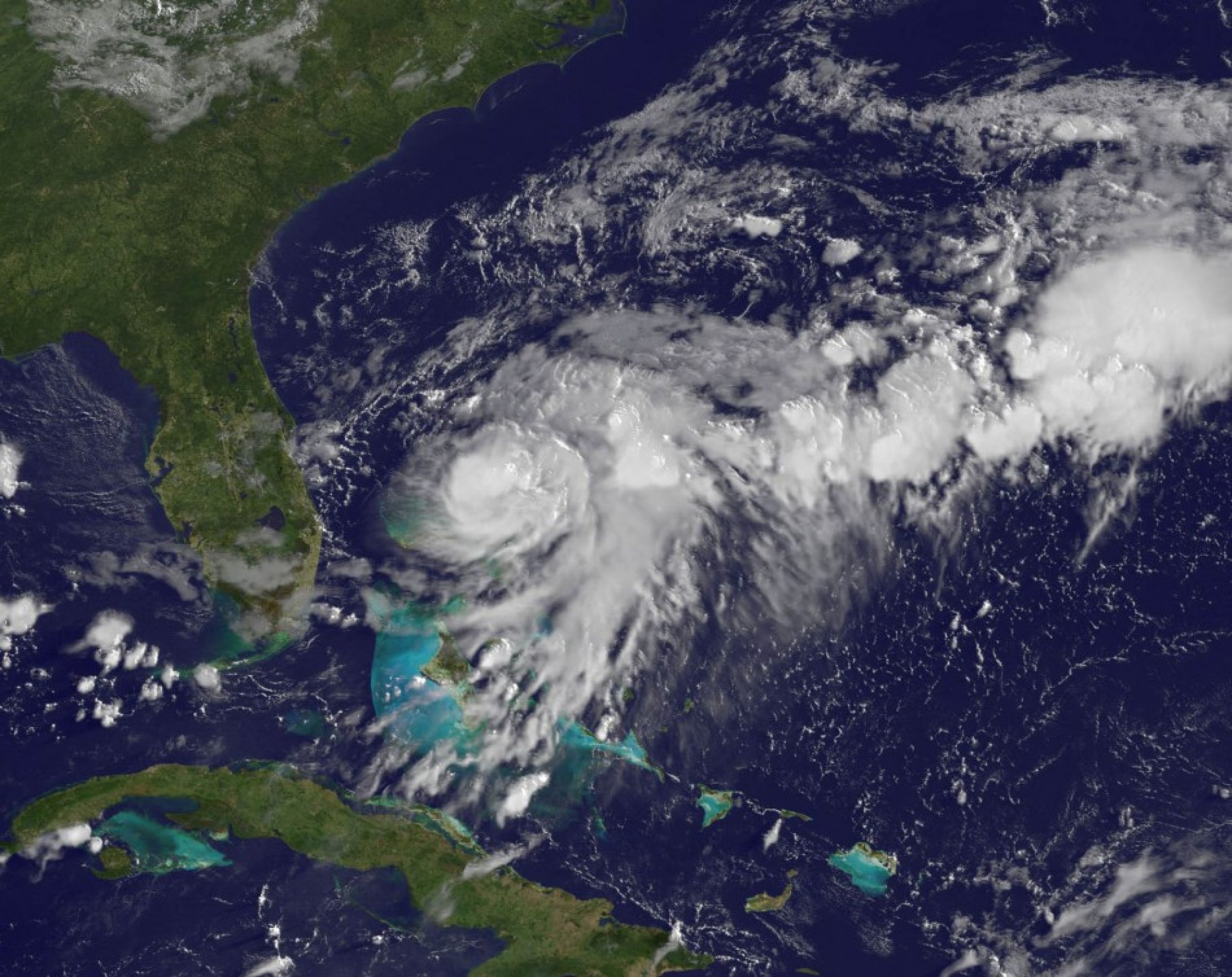
Intensifying Tropical Storm Bret over Atlantic Ocean Captured from Space (PHOTO)
NASA’s GOES-13 satellite that monitors weather over the eastern U.S. recorded images of the formation and strengthening of the tropical storm Bret over the Atlantic Ocean.
Bret, 2011 Atlantic hurricane season's second tropical storm, was born in the northwestern Bahamas and continues to intensify, NASA said in a statement.
The Geostationary Operational Environmental Satellite called GOES-13 provides continuous visible and infrared imagery of the eastern U.S. and Atlantic Ocean basin from its position in space, it said.
Based on the recordings, NASA revealed that a storm developed on July 17 and developed in the early morning hours of July 18th into the Tropical Storm Bret.
The National Hurricane Center (NHC) has issued a tropical storm warning for Grand Bahama Island and the Abaco Islands in the northwest Bahamas.
“Bret is moving towards the North-Northeast and a turn towards the northeast with an increase in forward speed is expected through Wednesday,” NHC said in a statement.
Though the maximum sustained winds decreased to near 60 mph, locally high surf conditions were expected along the northern facing beaches, it said, instructing beach goers to stay away from surfing.
Check out below the picture of the Tropical Storm Bret recorded by NASA’s GOES-13:

© Copyright IBTimes 2024. All rights reserved.


