Interactive Aerial NOAA Map Shows Irma Damage In Florida Keys

The damage from Hurricane Irma is still being realized by Florida residents and responders to the destruction. The storm that first passed through the islands and then went on to Florida and north to the Carolinas was one of the strongest and longest sustained storms to hit the area. Photos and videos of the storm from space showed the sheer size of Irma before it made landfall over the weekend.
The tentacles of the bow wave of #Irma clawing its way up Florida…. pic.twitter.com/BKCS8RrCnB
— Randy Bresnik (@AstroKomrade) September 10, 2017
Before even making it to the United States, Irma caused death and destruction in the Caribbean on islands like Barbuda, St. Martin, Turks and Caicos and others in the area. Upwards of 70 percent of the islands were destroyed making them inhabitable for the most part.
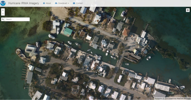
In areas where the storm has passed, the damage can be surveyed. The National Oceanic and Atmospheric Administration has started doing this by creating an interactive map, like this one that was made after Hurricane Harvey. The map of Irma’s damage isn’t as rounded out as the map of Harvey damage but NOAA plans to add more.
The images were taken by NOAA’s Office of Marine and Aviation Operations as well as the National Geodetic Survey. Remote sensing cameras that are on various NOAA aircraft were used to take the photos from about 1,600 to nearly 5,000 feet above the Earth. Then the photos were added online to start the map of damage.

The images can help response agencies assess damage that could impact travel and infrastructure caused by the storm, according to NOAA. The images are also being used to help develop new digital imaging standards.
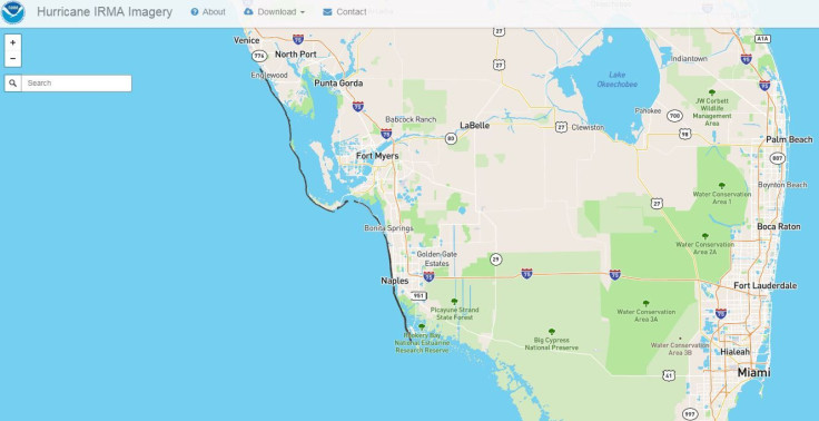
The map hasn’t been filled out yet but as the craft continue to take more photos NOAA expects to fill the map in. As of Wednesday morning the map only had photos taken during three flights. Currently the photos mostly cover the Florida Keys as well as the western coast of the state. The Keys were under a mandatory evacuation as of the Wednesday prior to Irma’s approach, and residents are still not yet allowed back to check on their flooded homes and property. A few photos of the area have surfaced on social media though and shows the severe destruction on the Keys.
The map shows that boats in the Keys that are out of place, debris in yards and the water near homes. It even shows some flooding in certain areas that have yet to drain. The images are so detailed that after zooming in it’s possible to see cars in driveways.
There were millions of Florida residents without power after Irma and it was unclear whether the roads were in good enough condition that residents of the keys could return yet. The map can be viewed here and will have more data as the week goes on.
© Copyright IBTimes 2024. All rights reserved.


