

'Large And Dangerous' Avalanches Possible In The West Amid Strong Pacific Storm

KEY POINTS
- Up to 4 inches of rain is possible in parts of California
- Avalanche danger is high in parts of Nevada's Inyo County
- Up to 24 inches of snow totals is possible in parts of Idaho
A strong Pacific storm that will affect the West Coast Tuesday has triggered Avalanche Warnings in some parts of the region, as rainfall combined with snow and strong winds have been forecasted to increase the risk of avalanches in affected areas.
"Increasingly stormy weather to impact the West Coast through Tuesday," the National Weather Service (NWS) said in its Short Range Public Discussion report published Monday.
The office added that there is also a potential threat "for widely scattered instances of flash flooding" at lower elevations in parts of the western U.S. through Wednesday morning.
In California, moderate to heavy rainfall is expected through Tuesday, the NWS in Sacramento tweeted. Small streams and creeks are expected to rise, which could then lead to urban flooding.
Moderate to heavy precipitation will impact interior #NorCal tonight - Tuesday. This will bring rises on small streams and creeks with localized urban flooding and increased runoff below pass level. Check road conditions before you go & never drive through flooded roadways! #cawx pic.twitter.com/v1swLlgvWe
— NWS Sacramento (@NWSSacramento) December 26, 2022
The heaviest rain of more than 4 inches is expected from Monday night through Tuesday afternoon.
In Utah, officials at the NWS in Salt Lake City said residents should expect winter weather to return to the state this week. The first system will start Tuesday, bringing rain showers across most valleys throughout Tuesday.
👂📢Winter Weather returns to Utah this week. More than one system is expected with the first one arriving Tuesday as a valley rain/mountain snow event. Keep https://t.co/xQwsdiBMVl handy as this wintry trend sticks around for a while! #UTwx pic.twitter.com/DscPgbBATg
— NWS Salt Lake City (@NWSSaltLakeCity) December 26, 2022
Over in Washington, mountain snow and lower-elevation rain is expected Tuesday, with some areas possibly seeing up to 3 inches of rainfall.
With the warmer temperatures comes significant lower elevation rain and mountain snow. But that's not all. Winds will increase tomorrow with the strongest winds in the evening to overnight hours ❄️🌧💨#wawx #idwx pic.twitter.com/WQb1xpm35o
— NWS Spokane (@NWSSpokane) December 26, 2022
The NWS in Portland has forecasted heavy rain and strong winds in Oregon through Tuesday. Some areas such as Santiam Pass could see up to 6 inches of rain, while Mount St. Helens could get up to 10 inches of rain.
A strong frontal system brings heavy rain and strong winds to NW OR and SW WA through Tuesday. Strongest winds along the coast, increasing tonight into Tuesday. Windy conditions inland late Tuesday morning and afternoon. Could see some minor flooding along rivers and creeks. pic.twitter.com/MtglFYxZlM
— NWS Portland (@NWSPortland) December 26, 2022
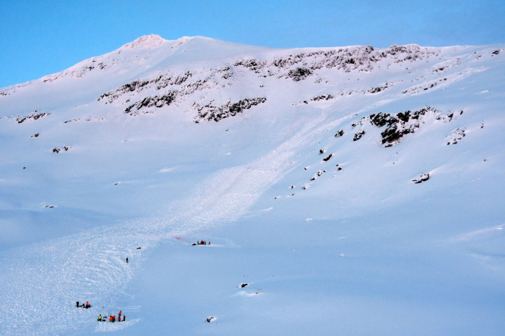
In Nevada, officials warned of a high probability of avalanche danger in portions of Inyo and Mono County as well as in the Central Sierra Mountains and the Greater Lake Tahoe Area.
An Avalanche Watch has been issued for portions of the Sierra Nevada mountain range, including the Greater Lake Tahoe area. Time frames and areas are listed in the graphics, for more information go to https://t.co/I84u0tsp1v🏔️❄️ pic.twitter.com/2uj0sVgq79
— NWS Reno (@NWSReno) December 26, 2022
For Colorado, officials at the NWS in Grand Junction noted that moderate snowfall is expected Tuesday and could transition to heavier snow by Wednesday.
A series of systems will impact the region beginning tomorrow and continuing through the end of 2022 with moderate to heavy snow accumulating in the higher elevations as well as some valleys. Here's a breakdown of 24-hour snow accumulations through Thursday night. #cowx #utwx pic.twitter.com/BBkYHirrJ9
— NWS Grand Junction (@NWSGJT) December 26, 2022
Officials at the NWS in Boulder also noted that avalanche danger could possibly go high by Wednesday afternoon. "Large and dangerous avalanches will be easy to trigger once the new snow accumulates. Avalanches will run naturally," the office said.
In Montana, officials at the NWS in Great Falls said some areas will see up to 12 inches of snow Tuesday as a mix of snowfall and rain hits the state.
The latest precipitation and snow potential tonight leaves the Rocky Mtn Front as well as mountains in SW MT seeing upwards of 12 inches of snow. Lower elevations won’t fare as well, seeing less than an inch of snowfall. Exercise caution if out and about during this time. #MTwx pic.twitter.com/sWW8j3UUgm
— NWS Great Falls (@NWSGreatFalls) December 26, 2022
In Idaho, Old Faithful and Island Park are expected to see up to 12 inches of snow accumulations, while Galena could see up to 24 inches of snowfall totals.
Winter Storm brings high snow totals to (generally) elevations above 6500ft, rain to those of us at the lower elevations. The "Rain Totals" graphic shows snow liquid equiv. in mountains, so focus on totals in the Magic Valley through Snake Plain instead. Windy Tuesday, too! #idwx pic.twitter.com/mK8IYqa94B
— NWS Pocatello (@NWSPocatello) December 26, 2022
Colorado – effective through 8 a.m. Thursday
- Park Range, Elkhead Mountains, Ruby Range, Flat Top Mountains, West Elk Mountains, Grand Mesa, San Juan Mountains, San Miguel Mountains, Rico Mountains, La Plata Mountains, Needle Mountains, Grenadier Range, Sawatch Mountains and Elk Mountains south of divide
Montana – effective through 7 p.m. Tuesday:
- Rattlesnake, Bitterroot, southern Swan Mountains and southern Missions
- Whitefish Range, John F. Stevens Canyon, Flathead Range, Maria Pass area and Apgar Range
Idaho – effective through 6 a.m. Tuesday:
- Kootenay, Cabinet, St. Regis Basin in Lookout Pass Zone
- Silver Valley
Idaho – effective through 8 p.m. Tuesday:
- Owyhee Mountains (wind gusts of up to 70 miles per hour possible)
Nevada – effective through 10 a.m. Tuesday:
- Lassen-Eastern Plumas-Eastern Sierra
- Greater Lake Tahoe Area (wind gusts of up to 130 miles per hour possible)
- Mono County (wind gusts near 100 miles per hour possible)
- Greater Reno-Carson City-Minden Area
- Northern Washoe County
- Mineral and Southern Lyon
California – effective through 10 a.m. Tuesday:
- Coastal Del Norte, Southwestern Humboldt, Del Norte Interior, Northern and Southern Humboldt Interior
- North and Central Sacramento Valley
- Motherlode
Oregon – effective through 7 p.m. Tuesday:
- North and Central Oregon Coast
- South Washington Coast
- Coast Range of Northwest Oregon and Central Coast Range of Western Oregon
- Willapa Hills
- South Central Oregon Coast and Curry County Coast (wind gusts of up to 75 mph possible)
- Central Siskiyou County
- Central and Southern Oregon Cascades
Montana – effective through 11 p.m. Tuesday:
- Madison River Valley
- Eastern Glacier National Park (wind gusts of up to 80 miles per hour possible)
Oregon – effective through Tuesday evening:
- Gold beach, Harbor, Ophir, Brookings and Pistol River
- Trask, Netarts, Willapa, Lees Camp, Ocean Park, Vernonia, Summit, Naselle, Raymond, Pacific City, Cathlamet, Ryderwood, Cape Disappointment, Long Beach, Cannon Beach, Jewell Astoria and Tillamook
California – effective through Tuesday afternoon:
- San Francisco, Scotts Valle, Santa Cruz, Live Oak, Day Valley, Watsonville, Pacifica and Boulder Creek
- Marina, Monterey and Seaside
- South Santa Rosa, San Rafael, Angwin, Woodacre, Petaluma, Tamalpais-Homestead, Lagunitas-Forest Knolls, Napa, Sausalito, Rohnert Park and Novato
Washington – effective through Wednesday morning:
- Marysville, Freeland, Lacey, Silverdale, Shelton, Tumwater, Aberdeen, Langley, Anacortes, Sequim, Sedro-Woolley, Evertt, Edmonds, Chehalis, Mount Vernon, Lynnwood, Seattle, Port Townsend, Fords Prairie and Olympia
© Copyright IBTimes 2024. All rights reserved.
- MOST POPULAR IN National


