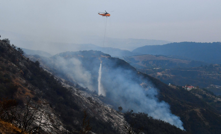
Military Drone Deployed To Increase Monitoring Of California Wildfires

The state firefighting service of California collaborated with a unit of California Air National Guard and deployed military wartime drones in order to receive real time photos and videos of the massive wildfire which spread across the area.
According to a report by USA Today, this is only the third time such collaboration had taken place. The Reaper MQ-9, operated by the 163d Attack Wing at March Air Reserve Base in the Riverside County, will fly five miles above and transmit relevant information to commanders on the ground. This also includes information about spot-fire detection.
Scott McLean, Deputy Chief of California Department of Forestry and Fire Protection, said, “It's out of the way.”
He added, “It has the capabilities to see that 30,000-foot level, figuratively (and literally) speaking. It enables our incident commander, our operations folks, to see the big picture all at once.”
Drones or Unmanned Aerial Vehicles are usually prohibited from flying around wildfires. But, small UAVs were added to search-and-rescue and firefighting operations in the Grand Canyon National Park. This program was launched in May in order to increase monitoring of fires and strengthen searches for missing hikers, the report stated. However, the drones that were flying above the Thomas Fire in California weren’t similar to the ones deployed in Grand Canyon.
According to Colonel Sean Navin, Commander of the 163d Attack Wing, the MQ-9 consists of a 66-foot wingspan and it weighs nearly 5,000 pounds. It takes around 12 members of the National Guard unit to take the drone to its natural altitude, which is at 28,000 feet. The moment the drone is airborne, a team of five guides will monitor the UAV over the area where the wildfire exists.
“Everybody and their brother is connected here to get this machine airborne,” said Navin Tuesday.
The report further said the Reaper drone is more powerful than the MQ-1 Predator. It is known for its significant loiter time and it can stay airborne for 15 hours. The teams battling the Thomas fire were using a second aircraft along with the drone in order to receive 24-hour reconnaissance of the area.
The drone is equipped with high technology infrared cameras that can take high resolution and full motion videos. Once the images and videos are sent, the incident managers along with the analysts will judge the behavior of the fire and then come to a decision as to where to deploy the resources at hand.
Navin stated, “It’s quite a chain of people to provide fire coverage.” “But without question, it's worth every second,” he added.
In earlier times, fixed-wing spotter planes flew over wildfires in the high altitudes. They coordinated with everything, from water deployed by the helicopters to smoke-jumper deployments. However, these planes depended on fuel, which limit their time in the air. Also, their range of vision was less than that of a wide-angled and high-definition camera.
McLean said, “When you have smoke and that type of thing where you don't have a visual, that makes things difficult.”
“This is a tool that flies pretty much in anything and has the capability to look through those smoky conditions,” he added.
The MQ-1 Predator drone was deployed during the Rim fire in Sierra Nevada, California in 2013. The second drone deployment was done in the wine-country wildfires in Northern California in October.
The Reaper drone was launched over the Thomas fire Dec.6 — just 36 hours after the Thomas fire started — by the U.S. Secretary of Defense. Navin stated it was possible only due to a more streamlined approval process and already existing agreements. Talks regarding the expansion of this program to states that are in risk of such disasters have begun, he added.
“The role will not diminish,” said Navin. “It is, quite frankly, a domestic-operations darling,” he added.
The Thomas fire in Southern California Sunday became the fifth largest wildfire in the history of California. By Tuesday, the fire was contained at 20 percent. Around 794 structures were destroyed and it led to the mandatory evacuation of approximately 93,000 people.
© Copyright IBTimes 2024. All rights reserved.


