

Minnesota Blizzard 2016 Pictures: November Snow In Morris, St. Cloud, Fergus Falls, Marshall, Willmar Could Bring Several Feet

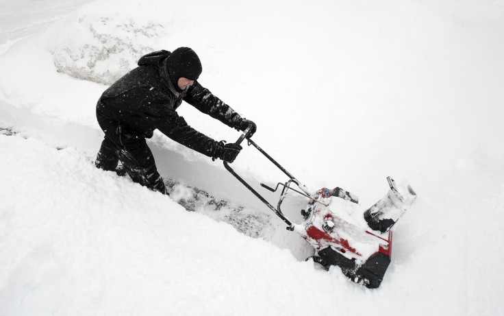
Heavy snow and blizzard-like conditions were expected to blanket the western portion of Minnesota and affect other parts of the state on Friday, according to the National Weather Service. Residents and businesses in some places were bracing for what could be as much as three feet of snow. Two deadly car crashes happened earlier in the day, though it was not immediately clear how many people had died.
The towns of St. Cloud, Fergus Falls, Marshall, Willmar, and Morris were especially forecast to be on the receiving end of some of the heaviest snowfall that could last into the evening, significantly affecting travel conditions, the Star Tribune reported.
@NWSTwinCities Snow Drifts approaching 3 ft already @ 9am by morris, MN. Power lines jumping like double dutch. Dangerous Blizzard!! pic.twitter.com/SyjtpDaJkE
— Nick & Amanda Elms (@PrairieWndChsrs) November 18, 2016
However, about six inches to 1 foot of snow was expected to be the average amount to fall Friday. It was the winds, which was forecast to be strong gusts as fast as 55 mph, that would cause the blizzard conditions, meteorologists said.
As such, some schools' start times were delayed by at least two hours Friday and the temperature was expected to plunge into the 20s as the day progressed into the evening.
TIMELAPSE: Snow falling on the U of MN Morris campus this morning. #mnwx pic.twitter.com/WVRDQWV41s
— AerisWeather (@AerisWeather) November 18, 2016
Two fatal car crashes that left at least 14 people hurt Friday have been attributed to the weather, and local officials are cautioning motorists to refrain from driving unless it is an emergency.
“With this being the first snow of the season, it will be very impactful. If you plan to travel to western Minnesota, you might want to wait out the storm,” National Weather Service meteorologist Michelle Margraf told the Star Tribune.
The view from the KNSI weather camera of Downtown St. Cloud as the snow starts to come down. pic.twitter.com/yv7f7rjjEA
— KNSI News (@KNSI) November 18, 2016
While the heaviest snow was projected to land in the state's northern and western regions, the rest of the state would also see some snow, just not as much.
The National Weather Service predicted the 2016-17 winter would bring much more snow and colder weather to Minnesota than it did last year. And while meteorology is not an exact science, forecasters are pretty confident the indicators will be correct.
I-94 at Alexandria. I-94 looks similar to this from the Alex area to Fergus Falls. Plows are out. pic.twitter.com/F3Jkle5wzy
— MnDOT District 4 (@mndotwcentral) November 18, 2016
"It’s about as sure a bet as you can get in meteorology that we’ll be colder and snowier than last winter," National Weather Service meteorologist Eric Ahasic told the Owatonna People's Press. However, this winter in Minnesota won't be any worse than years past, either, Ahasic added. "Definitely no signs point to it being a record-breaking year or anything like that," he said.
Near white-out in SE w/ slide-offs & accidents reported on I-94 S. of Fergus Falls. Hazardous travel! #VNLStormTeam pic.twitter.com/XtWiuNk7hF
— Valley News Live (@ValleyNewsLive) November 18, 2016
Below are some additional photos of the state's snowfall posted to social media Friday.
Beautiful day in Fergus Falls #winter2016 pic.twitter.com/iX8sPqJvZf
— Robert Fronning (@AgCRob) November 18, 2016
MN 23: Hanley Falls, MN near Marshall in SW Minnesota just now. Winds there gusting to near 50 mph with heavy snow. #blizzard pic.twitter.com/9SLpRHkvs2
— Ken Barlow (@kbarlowkstp) November 18, 2016
© Copyright IBTimes 2024. All rights reserved.
- MOST POPULAR IN National


