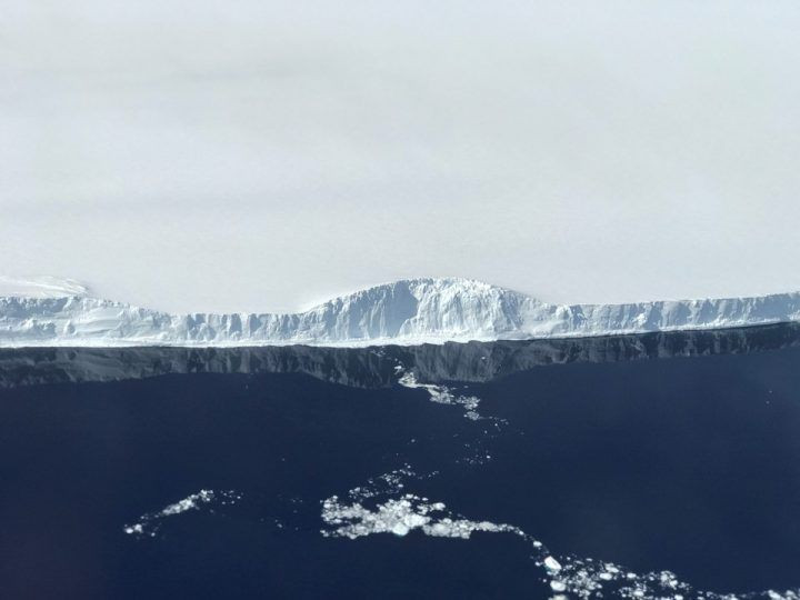
NASA Photos Show Massive Larsen C Iceberg Breaking Off Into Ocean

Scientists kept a close eye on the Larsen C ice shelf when a large rift appeared in it in late August last year. They kept watching as the crack in the shelf inched closer and closer to the edge before calving and effectively creating an iceberg this summer that was 2,200 square miles wide.
The iceberg broke off in July and since then scientists have been waiting to see where it would travel and how it would change as it floated along.
When the iceberg, called A-68, completely broke off, it reduced the size of the Larsen C ice shelf by a whopping 12 percent. It’s one of the largest icebergs researchers have ever observed so they’re not exactly sure what to expect from it. But the area where the berg detached from is now most likely highly unstable now. Meaning more ice will probably continue to break off of it. The possible movement of the berg was simulated using the tracks of 7,000 other icebergs, but that only gave researchers a vague idea of what was possible. The only way to really know the path it will take is to observe it.
Now, new photos from NASA’s Operation IceBridge show the berg on its way out to sea, further from the shelf it broke off from. It was difficult to get photos of it after it originally broke off because it was still winter time in Antarctica then, but now it’s summer and conditions have warmed up.
From yesterday's #IceBridge flight: Looking out from the sea ice to iceberg A68, which calved from Antarctica's Larson C ice shelf in July pic.twitter.com/0oq9dzUbz1
— NASA Ice (@NASA_ICE) November 1, 2017
The photos were posted to NASA’s Twitter account that is specifically for the branch of NASA that tracks ice all over the planet, and they’re spectacular looking.
From yesterday's #IceBridge flight: The edge of Larsen C Ice Shelf with the western edge of iceberg A68 in the distance pic.twitter.com/lN4lHanIfY
— NASA Ice (@NASA_ICE) November 1, 2017
The really show just how large the iceberg is, and how far it’s traveled from the ice shelf it originally broke off of. This photo taken on the 12 shows the edge of the A-68 berg.
The berg is made of fresh water, meaning as it floats, and melts, it will not only add water to the ocean raising sea level, but it will make the ocean less salty as well, which can lead to a number of global warming cycles. Right now, it’s still fairly close to the shelf it broke off of. A blog post on NASA’s Earth Observatory site said that in addition to taking photos, NASA was using a gravimeter to measure and map the iceberg and the shelf.
© Copyright IBTimes 2024. All rights reserved.


