

Possible 'Life-threatening' Blizzard Conditions Forecasted In Minnesota; Winter Storm In Neighbor States

KEY POINTS
- Wind chills are expected to fall 'to dangerous levels'
- Traveling risk is 'especially high,' officials warned
- Wind gusts of more than 50 mph are possible late Thursday
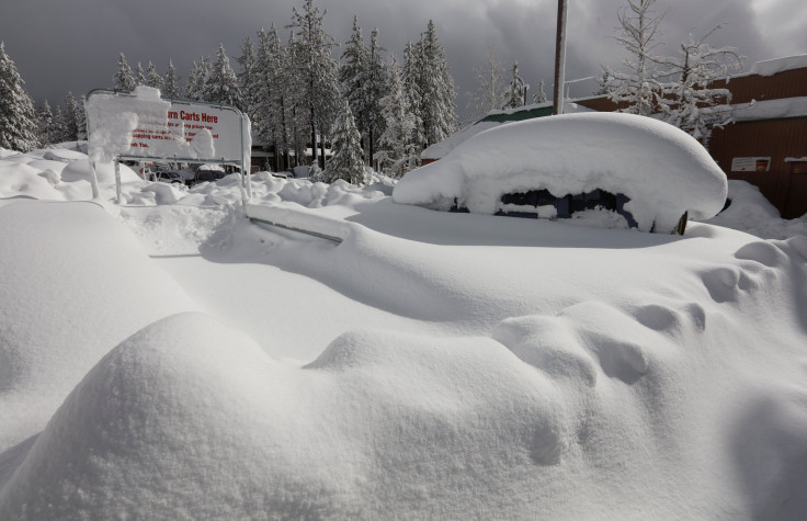
Heavy snow with "dangerously cold air" is expected in Minnesota and its neighboring states starting Thursday afternoon. Possibly "life-threatening" blizzard conditions have also been forecasted in the state as blowing snow is expected to make travel difficult from Thursday through Friday.
"Bitter cold and dangerous wind chills over the northern Plains to surge southward into the central U.S. through Thursday," the National Weather Service (NWS) said in its Short Range Public Discussion report published Tuesday.
Besides Minnesota, other central states like Wisconsin and Iowa are also under Winter Storm Warnings.
Blizzard conditions that bring wind gusts of more than 50 mph are possible late Thursday, the NWS in Twin Cities noted.
A Winter Storm Warning is in effect for accumulating snow on Wednesday. This will be followed by gusty winds and significant blowing snow Thursday afternoon through Friday night. Wind chills will fall to dangerous levels for anyone caught unprepared for the elements. #mnwx #wiwx pic.twitter.com/ALKQv1cYpF
— NWS Twin Cities (@NWSTwinCities) December 20, 2022
Officials said wind chills "will fall to dangerous levels for anyone caught unprepared for the elements."
The risk for travelers from Thursday through Saturday is "especially high," the agency warned, adding that rescue efforts will be "extremely difficult" and will have "life-threatening implications" for both stranded individuals and rescue groups.
In Wisconsin, officials at the NWS in Green Bay said the "greatest concern" from Thursday evening through Friday is drifting and blowing snow that could create near-blizzard conditions in affected areas.
Winter weather is expected late Wednesday through Saturday. First with snow, followed by strong winds, low visibilities, and cold wind chills.
— NWS Green Bay (@NWSGreenBay) December 20, 2022
Get more details on our weather story https://t.co/BbWdRmPzmI#wiwx pic.twitter.com/04pYeks5pW
Over in Iowa, officials at the NWS in Des Moines said it is "strongly advised" for residents in Mason City, Algona, Estherville, DSM Metro, Ames, Creston, Lamoni and Ottumwa to postpone travel plans if possible as travel is expected to be an "extreme" hazard Thursday and Friday.
The expected snow and strong winds will make travel difficult across much of central Iowa early Thursday morning through Friday, especially in rural areas. Be prepared for poor travel conditions with blowing/drifting snow producing near whiteout/blizzard conditions. #iawx pic.twitter.com/gFp9e4QjYO
— NWS Des Moines (@NWSDesMoines) December 21, 2022
Winter weather alerts in Minnesota
Blizzard Warnings effective from noon Thursday through 6 a.m. Saturday:
- Stevens, Pope, Swift (wind gusts of more than 50 mph, wind chills as low as 40 below zero possible)
- Brown, Kandiyohi, Chippewa, Redwood, Lac Qui Parle, Yellow Medicine, Renville
- Meeker, Sibley, Nicollet, McLeod (wind gusts of up to 45 mph, wind chills as low as 40 below zero possible)
- Blue Earth, Le Sueur, Waseca, Faribault
- Martin Watonwan, Steele, Freeborn
Winter Storm Warning effective through late Friday night:
- Douglas, Todd, Benton, Morrison, Stearns, Wright, Sherburne, Isanti, Mille Lacs, Kanabec, Anoka, Chisago, Dakota, Washington, Ramsey
Winter Storm Warning effective from noon Wednesday through 6 a.m. Thursday:
- Goodhue
Wind Chill Warnings effective from 6 p.m. Wednesday through noon Saturday:
- Lyon, Murray, Lincoln, Rock, Pipestone (wind chills as low as 45 below zero possible)
- Cottonwood, Nobles, Jackson
Winter weather alerts in Wisconsin
Winter Storm Warnings effective from 3 p.m. Wednesday through 6 a.m. Saturday:
- Taylor, Buffalo, Trempealeau (wind gusts as high as 45 mph possible)
- Adams, Crawford, Clark, Jackson, Grant, La Crosse, Juneau, Vernon, Richland, Monroe
- St. Croix, Rusk, Barron, Polk (wind gusts as high as 50 mph possible)
- Chippewa, Eau Claire, Pierce, Pepin, Dunn
Wind Chill Advisories effective through 10 a.m. Wednesday:
- Burnett, Douglas, Price, Washburn, Sawyer
- Ashland, Bayfield, Iron
Winter weather alerts in Iowa
Winter Storm Warnings effective from 3 p.m. Wednesday through 6 a.m. Saturday:
- Floyd, Howard, Mitchell
- Chickasaw, Fayette, Winneshiek, Allamakee, Clayton
- Adair, Audobon, Adams, Calhoun, Boone, Cass, Carroll, Cerro Gordo, Dallas, Crawford, Franklin, Emmet, Guthrie, Greene, Hancock, Hamilton, Hardin, Humboldt, Palo Alto, Kossuth, Sac, Story, Pocahontas, Wright, Worth, Winnebago, Webster
- Appanoose, Bremer, Black Hawk, Clarke, Butler, Davis, Grundy, Decatur, Jasper, Madison, Lucas, Marion, Mahaska, Monroe, Polk, Ringgold, Poweshiek, Taylor, Tama, Wapello, Union, Wayne, Warren
Wind Chill Warnings effective through noon Saturday:
- Buena Vista, Cherokee, Dickinson, Clay, Lyon, Ida, Osceola, O'Brien, Woodbury, Sioux, Plymouth
- Harrison, Fremont, Monona, Mills, Page, Montgomery, Shelby, Pottawattamie
© Copyright IBTimes 2024. All rights reserved.
- MOST POPULAR IN National


