

NASA Releases Stunning Photos Of Sahara Desert Turning Green Under Historic Rains
The Sahara Desert was hit by an extratropical cyclone earlier this month, leading some areas to receive more than 200 millimeters of rainfall

New photos released by NASA show the Sahara Desert — one of the most barren places on Earth — turning green after historic rainfall.
The Sahara Desert was among one of the places hit by an extratropical cyclone Sept. 7 and 8, which drenched areas that typically receive little rain. African countries Morocco, Libya, Tunisia and Algeria were also impacted by the cyclone.

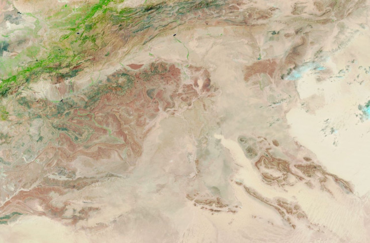
The Moderate Resolution Imaging Spectroradiometer (MODIS) on NASA's Terra satellite captured an image of the runoff and floodwater Sept. 10. The false-color image shows areas covered in water appearing in dark or light blue, according to NASA's Earth Observatory.
For comparison, NASA also shared a photo taken Aug. 14 in the same area, also showing some green patches of vegetation.
"While some degree of rainfall in this region happens every summer, what's unique this year is the involvement of an extratropical cyclone," Moshe Armon, a senior lecturer at the Institute of Earth Sciences and the Hebrew University of Jerusalem, told NASA.
The storm formed over the Atlantic Ocean and extended southward, meaning moisture was pulled from areas closer to the equator and dumped into the Sahara. Some areas received more than 200 millimeters of rainfall, according to preliminary satellite analysis.
© Latin Times. All rights reserved. Do not reproduce without permission.
- MOST POPULAR IN World


