Strange Storm-Chasing Autonomous Aircraft Collects Weather Data For NASA

NASA and the National Oceanic and Atmospheric Administration are working together to study the way severe storms form and intensify and they’re using their odd-looking Globe Hawk autonomous aircraft to do so.
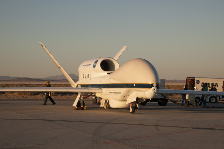
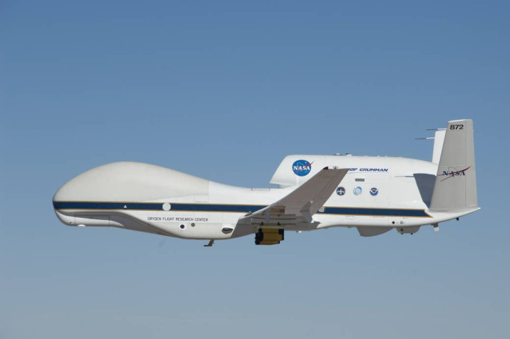
The craft looks kind of like a jet but it has no windows at the front where a normal jet would for the pilots to see and the back half of it resembles a double-decker plane. It’s also smaller than a jet and flies higher than most jets at 60,000 feet. Rather than transporting any material or people the craft flies high in the sky for up to 24 hours and takes measurements of storm systems.
With a wingspan of roughly 116 feet, a length of 44 feet and a height of 15 feet the craft isn’t anywhere close to the size of a jet. It boasts a range of 8,500 miles and has a portable ground control station that it can easily connect to to transit on-board data that it’s collecting while high in the sky.
The scientific payload the craft carries includes instruments designed to measure wind velocity, pressure, temperature, humidity, moisture levels in clouds and the structure of storm systems while flying. The instruments are so sophisticated that they can measure these elements of storms in a variety of ways including measuring them vertically rather than just in the spot where the craft is.
NASA and NOAA will be using the Globe Hawk for the Hands-On Project Experience Eastern Pacific Origins and Characteristics of Hurricanes campaign to learn about storms in the Northern Hemisphere. Generally for this research the craft stays in the Eastern Pacific Ocean but it could be sent to the Atlantic if need be. A primary goal of the campaign is to better understand storm intensification to help predict storms in the future as they become more frequent and cause expensive and sometimes life-threatening damage.
The craft’s ability to autonomously fly at high altitudes while it takes measurements opens a new door for science research in situations and areas in the world that aren’t easy or practical to monitor with manned aircraft or with satellites. The craft can take on different instruments depending on what conditions it will monitor which makes it more versatile for such research. It was originally designed as an unmanned surveillance craft for the Air Force.

It was first used by NASA to track and measure Tropical Storm Franklin in the Gulf of Campeche and has since been used for measurements by NOAA of Hurricane Gaston, Tropical storm Erika and others.
NOAA recently updated the hurricane outlook as we head into the Atlantic hurricane season. Originally the season was predicted to come in around average but now the expectations have been increased to an above normal season because of the number of storms that there have already been so far. The season is expected to bring more storms, some that might pop up unexpectedly like the recent Tropical Storm Emily in Florida, meaning more opportunities for the Global Hawk to gather valuable data.
© Copyright IBTimes 2024. All rights reserved.


