US Fires: NOAA-NASA Satellite Images Show Blazes, Aerosols Across The Country
KEY POINTS
- The Suomi NPP satellite captured two views of the ongoing fires in the U.S.
- A significant portion of the country is under the aerosol range that's potentially dangerous
- Of the states reporting large fires, California has the most reports with 23 large fires
A satellite has captured images of fires and aerosols spreading across the United States. Large fires across the country have burned over 2.7 million acres of land so far.
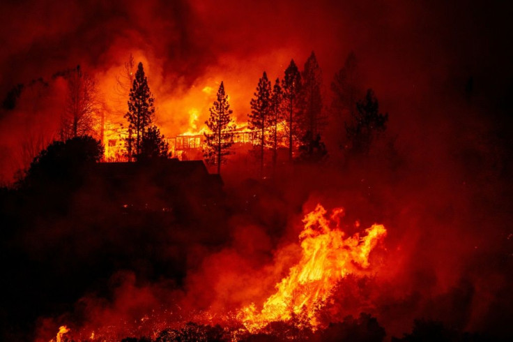
The U.S. has been experiencing a particularly harsh 2020 fire season, with the California fires alone burning a record 2 million acres of land.
SATELLITE SPOTLIGHT: This @NOAA #GOES17🛰️ loop from last Saturday shows how quickly Fresno County's #CreekFire grew after being sparked Friday evening. As of this afternoon, @CAL_FIRE says the #wildfire has grown to 144,000 acres and is 0% contained. #CaliforniaFires #CAwx pic.twitter.com/T8qLQkrwu9
— NOAA Satellites - Public Affairs (@NOAASatellitePA) September 8, 2020
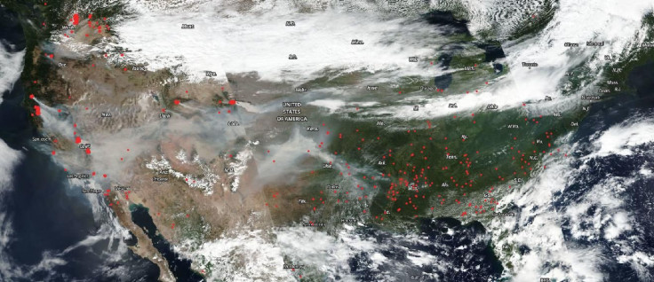
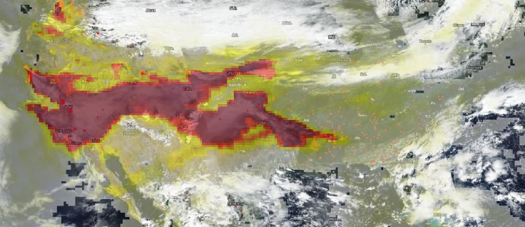
Apart from the massive California fires, other parts of the country were also experiencing fires. The fires were captured by the NOAA-NASA Suomi NPP satellite on Sept. 7, which offered two different views of how the fires were affecting the country.
The first is a true-color image wherein thick smoke can be seen blanketing a large part of the country, from California to Arkansas. In the image shared by NASA, the red dots signify the ongoing fires.

The second image includes data from the Ozone Mapper and Profiler Suite instrument aboard the Suomi NPP satellite, which shows the aerosols being released from the fires. Much of the aerosols captured by the instrument appears to be coming from the California area, traveling east across the country.

The yellows, oranges and dark reds mark different aerosol concentrations, with the deep reds being the levels that can affect visibility and become potentially dangerous to the health of the population in the area. Unfortunately, the image shows a significant portion of the country within the deep red range.
This year's fire season has been particularly harsh. Typically, western areas of the United States and Canada experience higher risks for wildfires from August to November and this year's season began with intensity.
As of Tuesday, the National Interagency Coordination Center (NICC), the body that coordinates wildfire resources across the country, reports that there are 87 large fires across the country.
Of the states reporting large fires, California has the most reports with 23 large fires, followed by Washington with 10 and Montana with nine large fires.
"Extreme conditions in several western states caused significant acreage gains on several large fires," the National Interagency Fire Center said in its Sept. 8 update. "During this unprecedented time, the safety of the public and all wildland fire responders is always the number one priority for all wildland fire agencies."

© Copyright IBTimes 2024. All rights reserved.


