US Hurricane Forecast: Louisana Starts Evacuation, New Orleans On State Of Emergency

Louisiana Gov. John Bel Edwards on Wednesday declared a state of emergency throughout the state and ordered evacuations ahead of the strengthening of Tropical Storm Barry, which is expected to intensify into a hurricane on Friday.
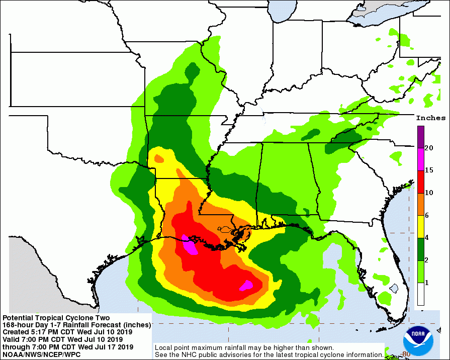
He said about 10 to 15 inches of rain might fall within 24 hours between Friday and Saturday.
"The entire coast of Louisiana is at play in this storm," he said, adding no one should take this storm lightly. A storm surge warning is in effect for coastal Louisiana parishes.
New Orleans Mayor LaToya Cantrell declared a state of emergency in her city.
“Because of intense thunderstorms, and the further potential for tropical or hurricane force winds and further thunderstorms, New Orleans may experience more widespread localized severe flooding and gale force winds that could result in the endangerment and threat of life, injury and possible property damage," she said.
The state is facing a calamitous weekend as flooding caused by Tropical Storm Barry continues. This storm shows every indication of becoming a hurricane bearing down on the state. New Orleans, which suffered grievously from the killer Hurricane Katrina in 2005, is reeling under unrelenting floods.
Reports say the city’s streets are now small, swift rivers infested with garbage. Water is up to the doors of many cars, many of which have been abandoned to the rising flood waters. Kayakers are paddling their way down some streets.
Plaquemines Parish has also ordered a mandatory evacuation of its community.
The incoming hurricane might hit the Gulf Coast and raise the Mississippi River to dangerous levels. New Orleans city officials fear additional rains will push the already swollen Mississippi precariously close to the tops of levees protecting New Orleans. The city is protected by levees 20 to 25 feet (6 to 7.6 meters) high.
The Army Corps of Engineers (ACE) in New Orleans, however, said it isn’t expecting widespread overtopping of the levees. There are concerns for areas south of the city and ACE is working with local officials to identify low-lying areas and reinforce them.
“We’re confident the levees themselves are in good shape. The big focus is height,” said ACE spokesman Ricky Boyett.
New Orleans officials are urging residents to stash at least three days of supplies and keep their neighborhood storm drains clear so water can flow unimpeded into the drains.
The ongoing storm is associated with an atmospheric disturbance in the Gulf of Mexico on track to strengthen into a hurricane by the weekend, said weather forecasters. The National Hurricane Center (NHC) expects the system to become a tropical depression by Thursday morning, a tropical storm by Thursday night and a hurricane on Friday.
The National Weather Service (NWS) anticipates the Mississippi to rise to 20 feet (6 meters) by Saturday morning. It said the river could crest at 19 feet, or 2.3 feet below the record.
© Copyright IBTimes 2024. All rights reserved.


