Weather: South Dakota Shuts Government Offices Due To Northern Plains Storm, Blizzard Warnings

KEY POINTS
- Gov. Kristi Noem ordered the closure of state offices in 26 counties
- Hazardous travel is possible in South Dakota on Friday
- Up to 18 inches of snow totals is possible in the Sierra Madre Range of Wyoming
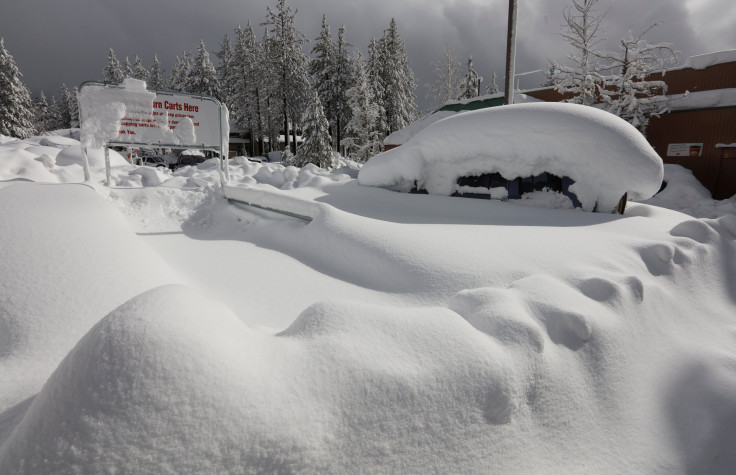
South Dakota Gov. Kristi Noem has ordered all government executive branch offices in certain counties across the state to close Friday as a major winter storm affecting the Northern Plains is expected to bring winter weather in many parts of the state. Blizzard conditions are expected in portions of the state, prompting weather officials to issue warnings.
The counties included in Gov. Noem's order, according to Dakota News Now, are Brown, Buffalo, Campbell, Clark, Codington, Corson, Day, Deuel, Dewey, Edmunds, Faulk, Grant, Hamlin, Hand, Hughes, Hyde, Jones, Lyman, Marshall, McPherson, Potter, Roberts, Spink, Stanley, Sully and Walworth.
The National Weather Service (NWS) in Sioux Falls said at 10:45 p.m. Thursday that residents of Harrisburg, Tea and Lennox should prepare for small hail as thunderstorms hit the area.
1045 pm: Those in the southern and southeastern parts of Sioux Falls, including surrounding areas of Tea, Harrisburg, Lennox may see some small hail as thunderstorms arrive.
— NWS Sioux Falls (@NWSSiouxFalls) March 31, 2023
Travel will likely be hazardous Friday as strong winds with snow are expected to affect parts of south-central South Dakota starting late Friday morning, the NWS in Rapid City warned. The highest snowfall accumulations are expected in White River (13 inches), Onida (17 inches) and Pierre (18 inches).
3/30/2023, 2:45 pm MDT: Here is a look at the winter storm warnings and advisories for the snowstorm tonight and Friday. Notable impacts are possible, especially from the Black Hills eastward. #SDwx #WYwx pic.twitter.com/jwe0TjhLoL
— NWS Rapid City (@NWSRapidCity) March 30, 2023
South Dakota isn't the only northern state experiencing winter weather conditions going into the weekend. Officials have said heavy snow and blizzard conditions are likely in parts of the Northern Plains.
"Heavy snows and significant icing are likely from portions of the Northern Plains, east northeastward through the upper Mississippi Valley and into the upper Great Lakes region" on Friday, the Weather Prediction Center (WPC) said Thursday.
Weather officials at the NWS in Grand Forks said gusty winds and heavy snow will likely affect travel in North Dakota as the wintry mix through Friday night could result in icy roadways.
Confidence has increased in locations within southeast ND into west-central MN to see at least 6 inches of snow midday Friday into Friday night. Gusty winds and heavy snow may create very difficult travel from near blizzard conditions and significant drifting. #ndwx #mnwx pic.twitter.com/kmSyjlB8ZD
— NWS Grand Forks (@NWSGrandForks) March 30, 2023
Many parts of North Dakota will experience patchy blowing snow, while Jamestown, Lisbon and Linton will get blowing snow Friday. Ashley residents will experience near-blizzard conditions, officials at the NWS in Bismarck said.
Gusty winds will lead to blowing and drifting snow, especially over parts of south central North Dakota and the James River Valley late tonight and Friday. This could lead to near-blizzard to blizzard conditions. #NDwx pic.twitter.com/t2zhC8KJoS
— NWS Bismarck (@NWSBismarck) March 30, 2023
In Montana, up to 12 inches of snow is possible in elevations above 4,000 feet, the NWS Missoula said.
Over in Wyoming, up to 18 inches is expected through Friday in the Sierra Madre Range. Wind gusts of up to 65 mph are also possible through Saturday, the NWS in Cheyenne warned.
30/715PM: Multiple weather headlines in effect for the Nebraska Panhandle and SE WY through Friday evening. #wywx #newx #wyoroad pic.twitter.com/rqXdp6BVGz
— NWS Cheyenne (@NWSCheyenne) March 31, 2023
Officials at the NWS in Grand Junction are expecting up to 16 inches of snow and wind gusts of up to 60 mph in Colorado through Friday. Mountain snow showers are also possible, while rain showers are expected in the valleys.
Another storm is coming in today with winds 45 to 60 mph and mountain snow showers today and tomorrow putting down 4 to 16 inches snow. The valleys will see rain showers today and tomorrow. #COwx #UTwx pic.twitter.com/uwqeloYwBK
— NWS Grand Junction (@NWSGJT) March 30, 2023
In Nebraska, winds gusting up to 60 mph are expected to combine with snow, causing reduced visibility in the northeast portion of the state through Friday, the NWS in Omaha said.
The strong storm system will bring snow to the area Friday afternoon and night. Accumulating snow is forecast for northern NE and northern IA. Combined with the snow, west to northwest winds will gust up to 55 mph which could create near white-out conditions at times. pic.twitter.com/AEznb0cH5Y
— NWS Omaha (@NWSOmaha) March 30, 2023
Earlier Thursday, the NWS in North Platte said officials were concerned that blowing snow will result in hazardous travel for much of Friday.
Alerts in South Dakota
Blizzard warning effective from 7 a.m. through 6 p.m. Friday:
- Campbell, Corson, Dewey and Walworth
Blizzard warning effective from 7 a.m. through 10 p.m. Friday:
- Hughes, Jones, Lyman, Stanley and Sully
Blizzard warning effective from 7 a.m. Friday through 1 a.m. Saturday:
- Buffalo, Edmunds, Faulk, Hand, Hyde, McPherson and Potter
Blizzard warning effective from 9 a.m. Friday through 4 a.m. Saturday:
- Brown, Clark, Day, Marshall and Spink (wind gusts of up to 55 mph possible)
Blizzard warnings effective from noon Friday through 7 a.m. Saturday:
- Grant and Roberts (up to 12 inches of snow possible)
Blizzard warning effective from 4 p.m. Friday through 4 a.m. Saturday:
- Aurora, Beadle, Brule, Charles Mix, Davison, Douglas, Gregory, Jerauld and Sanborn (wind gusts of up to 55 mph possible)
Blizzard warning effective from 4 p.m. Friday through 7 a.m. Saturday:
- Codington, Hamlin and Deuel
Blizzard warning effective from 7 p.m. Friday through 4 a.m. Saturday:
- Brookings, Kingsbury, Lake, Miner and Moody
Alert in North Dakota
Winter storm warning effective from 7 a.m. Friday through 4 a.m. Saturday:
- Richland and Sargent (wind gusts of up to 50 mph possible)
Alert in Wyoming
Winter storm warning effective through 7 p.m. Friday:
- Sierra Madre Range (up to 18 inches of snow possible)
Alert in Colorado
Winter storm warning effective through 6 p.m. Friday:
- Elkhead Mountains, Park Mountains and Flat Tops
Alerts in Nebraska
Winter weather advisory effective through 7 p.m. Friday:
- Dawes and North Sioux
Winter weather advisory effective from 7 a.m. through 7 p.m. Friday:
- Sheridan and western Sherry
Winter weather advisory effective from 7 a.m. through midnight Friday:
- Boyd, Brown, eastern Cherry and Keya Paha
© Copyright IBTimes 2024. All rights reserved.
- MOST POPULAR IN National