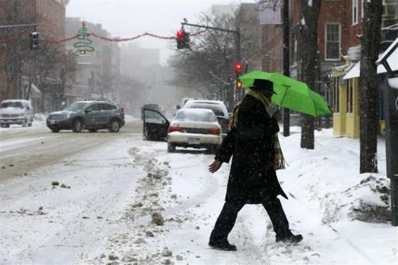
Winter Storm Hercules Flexes Muscles Over US Northeast, Poised To Dump Snow From DC to Maine

The Eastern U.S. -- from the Appalachians to Maine -- is bracing for a snowstorm to close out this first week of 2014, with major implications for travel-related businesses and municipal snow-removal resources.
The Weather Channel, which began naming winter storms in the 2012-2013 season, has dubbed this snowy maelstrom Winter Storm Hercules. Hercules is flexing his muscles over the Northeast at the same time that the region is getting blasts of cold air from the Arctic.
The National Weather Service has issued winter storm warnings for most of southern New England, New York, New Jersey and northern Pennsylvania. Snow started falling in the Northeast early Thursday morning, but the heaviest fall is expected Thursday night into Friday morning. The storm is expected to drop more than a foot of snow in the Boston metro area, between six and 12 inches in the New York City area. As of Thursday afternoon, Pennsylvania spotters were already reporting up to five inches of snow.
“For many areas, this will be a dry, powdery snow,” Accuweather meteorologist Alex Sosnowski wrote. “However, along the mid-Atlantic coast and even southern New England coast for a brief time, a wintery mix will occur early. As colder air invades the storm, wet areas will freeze and the snow will become powdery.”
Blizzard warnings are in effect for most of Long Island, N.Y., and Massachusetts’ South Shore. On Long Island, the NWS is forecasting accumulations of six to 10 inches of snow, with winds of 20 to 30 miles per hour and visibility of less than a quarter-mile. On the South Shore, NWS expects 10 to 14 inches of snow, with winds of 20 to 30 mph and gusts of up to 50 mph. People are urged not to travel in blizzard conditions.
In New York City, the Metropolitan Transit Authority is prepping for the frigid weather and snow. No service changes have been announced yet, but travelers should keep an eye the MTA’s website for updates through the coming days.
Massachusetts state workers are heading home early today, and Governor Deval Patrick encouraged private employers to pack their workers off early as well, according to the Associated Press. Boston’s Logan International Airport will be open during the storm, but there may not be any flights in or out after 8:30 p.m. on Thursday. Dozens of Friday flights have already been delayed or canceled.
Another blast of Arctic air is expected this weekend and early next week, and will send temperatures diving from the Midwest to the East Coast. Parts of the Midwest could see low temperatures in the -20s, according to The Weather Channel.
© Copyright IBTimes 2024. All rights reserved.


