Winter Storm Nemo Poised To Bury New England With Up To 2 Feet Of Snow

With Winter Storm Nemo bearing down, weather experts are advising New Englanders to brace themselves for historic levels of snow and wind. It’s definitely not a weekend to go out on the town.
Weather Underground meteorologist Shaun Tanner wrote on Wednesday night that Nemo will be a complex and ‘double-barreled’ storm.
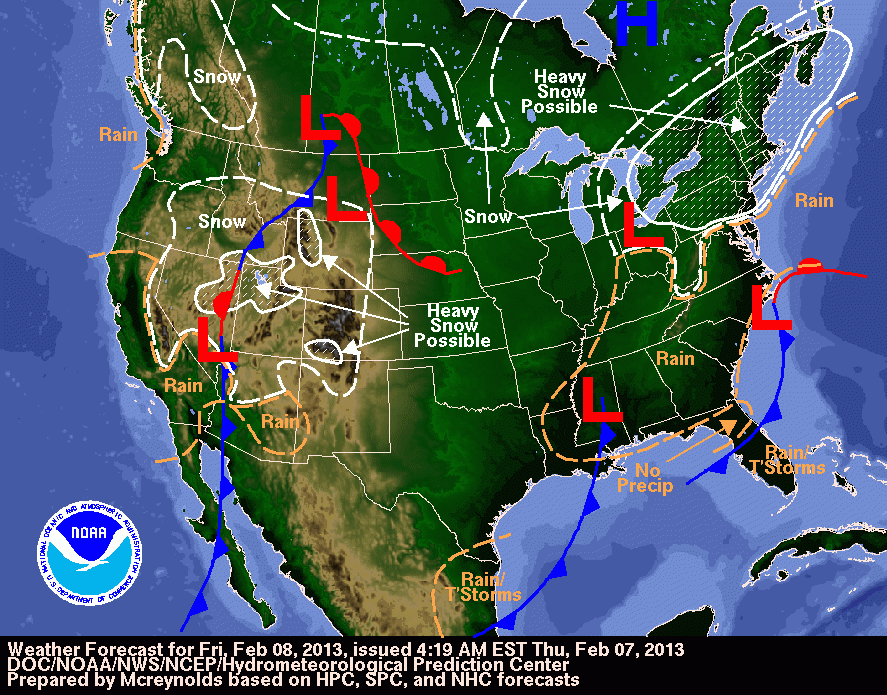
Nemo will be spawned on Friday, as a fast-moving cold system called an Alberta clipper sweeps in from the Midwest to meet a storm coming up the eastern seaboard. The two storms will combine off the northeast coast, creating a nor’easter that could set records throughout the region.
“The storm combination will remain off the Northeast coast once it combines late Friday or early Saturday,” Tanner wrote. “This type of setup certainly has the potential for very nasty weather in New England Friday and into Saturday.”
Winter storm advisories are popping up all over New England, with blizzard watches posted for most of eastern Massachusetts, including Boston. Nemo could dump up to two feet of snow across New England, but the other main ingredient for a blizzard is wind -- and New England could be seeing gusts up to 55 miles per hour. Cape Cod is also getting a Hurricane Force Wind Watch between Friday night and Saturday afternoon.
“Let's keep this in perspective, however,” Tanner wrote. “This does not mean a hurricane will be hitting the Cape Cod area, just that winds up to hurricane force will be possible.”
Residents in areas where high winds are expected should prepare for possible power outages and dangerous, damaging gusts. Exercise extreme caution, especially if there’s a hurricane force wind watch; these strong gusts can tear off roofs and break windows.
According to the National Weather Service, there have only been six storms in Boston where the snow piled up higher than 20 inches since 1892. While Nemo probably won’t match the record, set in 2003 by a storm that dumped 27.5 inches on Boston, anything above 18.2 inches will secure it a spot in the top-10 list.
Cities outside of New England are also looking at a snowy weekend. New York City, Syracuse and Buffalo, N.Y., and Grand Rapids, Mich., plus northern New Jersey and northeastern Pennsylvania, could see six inches or more of snow.
Today, the snow will mostly be confined to the Midwest, but parts of New England, upstate New York and even New York City could see flakes falling Thursday night. Friday will kick things off in earnest, with snow in southern New England, spreading over the whole region through the evening. But the precipitation should trickle off by Saturday morning in New York, and Saturday evening in Boston. Maine will get to enjoy the snow until early Sunday morning.
Major delays are expected this weekend at airports from JFK and La Guardia to Boston-Logan, with possible airport closures in New England if wind and snow become extreme.
Weather Channel meteorologists Chris Dolce and Jon Erdman urged people to stay safe on Thursday.
“If you venture out from Friday evening through Saturday in New England, the Hudson Valley, possibly as far south as northern New Jersey, Long Island and the New York City metro area, you may be stranded due to heavy snow, high winds and local blizzard conditions!” they wrote. “If you need to run errands or travel by car in these areas, it would be best to complete those travel plans by midday Friday!”
© Copyright IBTimes 2024. All rights reserved.


