

Winter Storm Triggers Blizzard Warnings For Parts Of Midwest, Including Minnesota And South Dakota

KEY POINTS
- Parts of Minnesota and South Dakota are under Blizzard Warning
- Many townships are under Winter Weather Advisory
- Areas across the upper Midwest are preparing for the season’s “first significant snowfall”
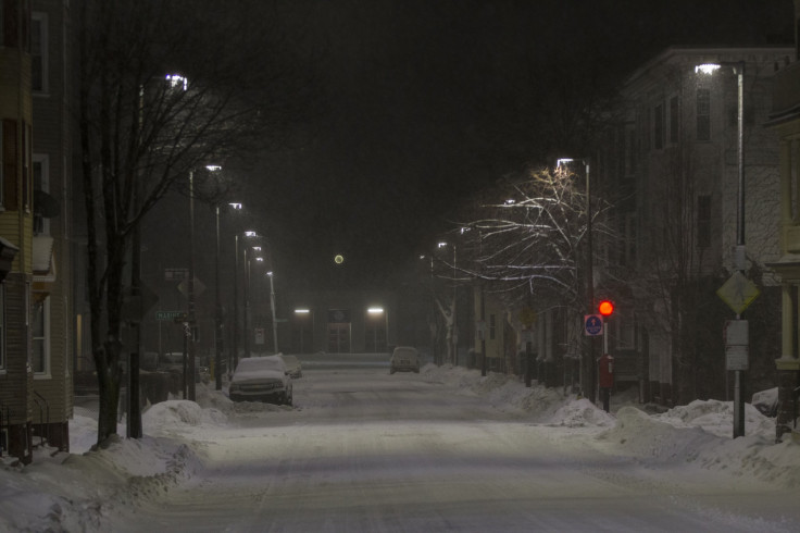
Blizzard warnings have been placed for several parts of the Midwest, including areas in Minnesota expected to be affected by heavy snow. Reduced visibility is also expected in some areas across west central Minnesota.
In its 6 p.m. update Thursday, the National Weather Service (NSW) in Aberdeen placed Watertown, Minnesota, under Blizzard Warning as well as a portion of Aberdeen, South Dakota. “Continuing strong NW winds, and increasingly steady snow across ne SD and wc MN will lead to significantly reduced visibility at times through Fri AM hours,” the agency warned, adding that residents should expect possible difficulties in morning and evening commute.
The NWS in Twin Cities also announced a Winter Weather Advisory in effect across parts of central and south-central Minnesota through Friday morning. For areas under Blizzard Warnings, residents are encouraged to stay at home except for emergencies, while those under Winter Weather Advisories are advised to practice caution when driving.
Continuing strong NW winds, and increasingly steady snow across ne SD and wc MN will lead to significantly reduced visibility at times through the Fri AM hours. While weather conditions improve some by and through Fri afternoon, travel may well still be hazardous. #sdwx #mnwx pic.twitter.com/WhRdUABEGu
— NWS Aberdeen (@NWSAberdeen) November 12, 2021
Active weather is impacting wide swaths of the U.S. today. Heavy rain could produce flash floods or debris flows in the PacNW. Heavy snow & high winds are creating areas of blizzard conditions in the Upper Midwest. Showers extend along a cold front slowly moving across the East. pic.twitter.com/vaAQxo8ary
— National Weather Service (@NWS) November 11, 2021
CBS News compiled a list of other areas under Blizzard Warning Friday:
- Wheaton, Minnesota
- Ortonville, Minnesota
- Britton, Michigan
- Sisseton, South Dakota
- Webster, Minnesota
- Milbank, South Dakota
- Hayti, South Dakota
- Clear Lake, Minnesota
NWS Twin Cities also released a list of areas under Winter Weather Advisory, which will be in effect until noon Friday:
- Long Prairie
- St. Cloud
- Madison
- Benson
- Montevideo
- Willmar
- Litchfield
- Granite Falls
- Olivia
- Hutchinson
- Gaylord
- Redwood Falls
- New Ulm
- St. Peter
- Le Sueur
- St. James
- Mankato
- Waseca
- Owatonna
- Fairmont
- Blue Earth
- Albert Lea
The NWS noted that “snow accumulations of 2 to 4 inches” are expected as well as “winds gusting as high as 55 mph.” The Blizzard Warnings will be in effect until 6 p.m. Friday unless declared otherwise.
Travel impacts are expected tonight through tomorrow morning across west-central and south-central Minnesota. 2-4" of snow accumulation is expected, along with wind gusts in excess of 40 mph.
— NWS Twin Cities (@NWSTwinCities) November 11, 2021
Get an hourly forecast for your location here: https://t.co/OS2u4bJge4 #mnwx #wiwx pic.twitter.com/AHENNJFk7t
Earlier on Thursday, the NWS Weather Prediction Center said a “strong storm system will impact the Northern Plains and Upper Midwest will produce light to moderate snowfall” throughout Friday. By early Friday, AccuWeather predicted that the storm system, “known as an Alberta Clipper,” will affect Minnesota through Saturday.
CNN meteorologist Dave Hennen said many parts of the Upper Midwest are “under some sort of winter alert as the season’s first significant snowfall is forecast.” After passing through the upper Midwest, it is expected that the storm will expand and move gradually eastward.
© Copyright IBTimes 2024. All rights reserved.
- MOST POPULAR IN National


