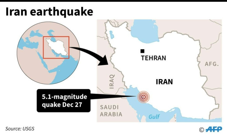
5.1 Magnitude Earthquake Strikes Near Nuclear Plant In Iran, No Damages Reported

KEY POINTS
- 5.1 Magnitude earthquake strikes Iran
- The quake originated near the only nuclear power plant
- No damages were reported after the calamity
A 5.1 magnitude earthquake hit near a nuclear power plant in the south-western region of Iran on Friday.
The quake originated nearly 50 kilometer (31 miles) from the nuclear plant in Borazjan, Bushehr Province. The earthquake was first felt at around 5 a.m. local time, Friday (8.30 p.m, Thu, EST).
There was no damage to the Bushehr nuclear power plant due to the earthquake and no injuries were reported. However, officials at the plant are yet to issue a statement about the same.
The US Geological Survey said the earthquake took place at a depth of around 38 km (23.6 miles) which was considered to have increased the effects of the tremor in the area.
The Bushehr Nuclear Power Plant is Iran’s first and only nuclear power station to provide electricity for consumption by the residents. The plant was opened in August 2010 and was designed to withstand a magnitude 8 earthquake without serious damages.
The head of the provincial emergency department in Iran told local media that there were no damages reported after checking with the “village councilors and officials in the area”.
Iran has been prone to earthquakes and the last quake recorded was a 5.9 magnitude that hit the East Azerbaijan Province on Nov. 7. Five people were killed and more than 300 were injured. The majority of the injuries were due to panic among the people that caused stampedes. The quake had originated around 250 miles northwest of the capital city of Tehran.
© Copyright IBTimes 2024. All rights reserved.


