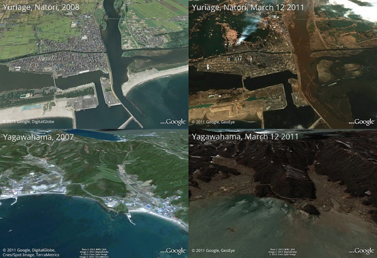
Google Earth releases latest post-earthquake images of Japan

As Japan continues to reel under the aftereffects of the powerful earthquake that stuck the country's pacific coast on Friday afternoon, the world still stands in shock of the devastation caused by the quake and the consequent tsunami. As the rescue, rehabilitation and rebuilding efforts start, the country is under severe threat of a nuclear disaster as the plants continue to report explosions and fires.
In response to the devastating earthquake and subsequent tsunami that struck Japan, Google Earth has worked out with satellite imagery providers to get the latest available data of the areas affected most, Ryan Falor from the Google Crisis Response team wrote on its official blog.
We're working to provide this data directly to response organizations on the ground to aid their efforts. We hope this new updated satellite imagery is valuable for them as well as everyone else following this situation to help illustrate the extent of the damage, the blog said.
© Copyright IBTimes 2024. All rights reserved.


