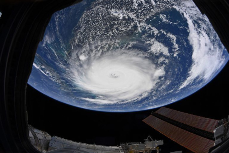
Hurricane Dorian Update: Dorian Downgraded To Category 2, Begins Slow Crawl Up East Coast

Hurricane Dorian will continue its march up the east coast Tuesday while hitting the Bahamas hard for one more day.
Dorian first hit the Bahamas on Sunday, reaching Category 4 and making it the biggest storm of 2019. The Bahamas northwestern islands have been hit the hardest, being lashed with winds well over 60 mph and destructive flooding. The storm is starting to pick up movement again. Tuesday is expected to be the last day of wind and rain the Bahamas will receive from Dorian.
The week ahead, however, will see the east coast hammered by Dorian as it begins to slowly move its way north.
The National Hurricane Center's most recent update has Dorian traveling north, starting with Florida’s southeast coastline. Florida Gov. DeSantis had previously announced a state of emergency to prepare and ordered evacuations of the coastal areas most at risk from the storm. Evacuations efforts have subsequently spread to Georgia and South Carolina, whose coasts are most at risk after Dorian passes Florida.
Despite the NHC downgrading the storm to a Category 2 hurricane, the storm has continued to grow in overall size. Hurricane-strength winds have been felt as far as 60 miles from Dorian’s center, while tropical storm winds can be felt 175 miles from the center.
The NHC has also said the risk of flash flooding along the Florida peninsula will increase as the day goes on, which will extend to the Mid-Atlantic area as the week goes on. It is expected to stem from storm surges deemed life-threatening for anyone living along the southeastern coast of the U.S.
© Copyright IBTimes 2024. All rights reserved.


