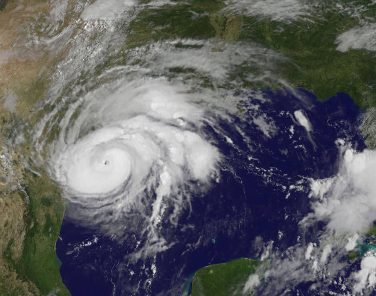
Hurricane Harvey Storm Surge Warning And Tornado Watch Updates

When Hurricane Harvey, a category three hurricane, makes landfall it’s expected to drop inches if not feet of water on Texas but there’s something else forecasters are worried about: the storm surge that Harvey will cause. Storm surge is what caused some of the most severe damage during other hurricanes like the damage caused in New Jersey and New York during Hurricane Sandy in 2012.
What is storm surge?
The National Hurricane Center has released its first ever storm surge warning. A storm surge happens during storms when the ocean water rises to abnormal levels (levels higher than the astronomical prediction) and then that water is pushed onto land by the wind of the storm. Multiple factors work to make storm surge happen and a change in any one of those factors will change the surge, which is part of the reason it can be so difficult to accurately predict.
The maximum potential storm surge is calculated using the storm intensity, forward speed, size, angle the storm approaches the coast at, central pressure and the features of the coast and the land. All of these factors can change how damaging the surge can be.
While #NASA satellites track #Hurricane #Harvey2017, we want to remind our followers that when officials say it is time to evacuate... go! pic.twitter.com/VBtsHyqWMc
— NASA Earth (@NASAEarth) August 25, 2017
The NHC provides maps of all different measurements during a hurricane like Harvey. Maps of the expected precipitation, expected wind speed, expected path and others, like expected storm surge. Upon selecting the storm surge map on the NHC site a message appears that warns users that the map is just a prediction or forecast. The warning reads: “ Due to forecast uncertainty, the actual areas that experience life-threatening inundation may differ from the areas shown on this map.” But it encourages users to follow the evacuation recommendation of the authorities in the area, “All persons, regardless of whether or not they are in the highlighted areas shown by the graphic, should promptly follow evacuation orders and other instructions from local emergency management officials.” Before users can view the storm surge map they have to select “I understand” under this warning message.
The map then shows the coast and cities of Texas highlighted with bright pink for the areas where there is a “storm surge warning” and highlighted in purple for areas where there is a “storm surge watch.”
The difference between the “watch” and the “warning” is that a “watch” means there is a “possibility of life-threatening inundation from rising water moving inland from the shoreline” usually within 48 hours, according to NHC. A “warning” on the other hand is a bit more seriously, it’s classified by the “danger of life-threatening inundation from rising water moving inland from the shoreline,” within a shorter time frame of 36 hours.
Harvey is also threatening the areas around the storm with the possibility of tornados. The Storm Prediction Center has issued a tornado watch in the areas near the coasts of Texas and Louisiana until Saturday morning.
A list of mandatory and voluntary evacuations can be found online as well as shelters. Updates of the storm can be found online on the NHC’s website as well as on these apps.
© Copyright IBTimes 2024. All rights reserved.


