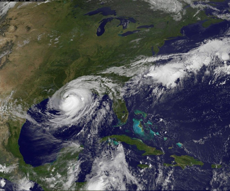
Hurricane Isaac: Levees Topped South Of New Orleans

As Hurricane Isaac made its second landfall Wednesday morning at Port Fourchon, La., officials in Plaquemines Parish just south of New Orleans are reporting flooding as deep as 12 feet in some areas that has stranded residents.
"The devastation of my house is worse than Katrina and the flooding in Woodlawn [about 30 miles downriver from downtown New Orleans] is worse than Katrina, so those things tell me that the damage on the east bank is worse than Katrina," Plaquemines Parish President Billy Nungesser told NOLA.com Wednesday morning.
"The water came up so quick it looks like we lost everything," a local resident told local news station WWLTV phoning in from his attic, where he took refuge.
The Army Corps of Engineers is reporting that the levee system was overtopped by a 13-foot surge that passed over an 8.5-foot wall at two points in the area, but there are no reports of any all-out breaches (such as a levee collapse) as the surge pushes water under walls and berms, as occurred exactly seven years ago today with Hurricane Katrina. Emergency responders began examining the damages at sunrise.
The affected section of the levee system protects a narrow strip of land between the Mississippi River and a massive bayou that melts into the Gulf of Mexico to the east that has been carved up by boat channels and eroded by saltwater incursions for decades, weakening the natural wetland storm-surge barrier.
Local news reports said flooding in some places in Plaquemines reached up to 12 feet, according to CNN, stranding over a dozen residents. No injuries or deaths have yet been reported.
Meanwhile, at least 486,000 residents in south Louisiana are without power as winds over 80 mph lashed power lines and sent water from Lake Ponchartrain onto roadways. New Orleans neighborhoods along the lake are some of the lowest in the city.
In New Orleans, where most of the 1,833 casualties from Hurricane Katrina took place, the levees were expected to hold. No breaches have been reported. The relatively minor flooding from the lake was expected. The main concern Wednesday was about drivers risking passage on some roads along the lake where water might be deeper than they expect.
The Category 1 hurricane stalled temporarily and is now moving slowly inland, which means more water will be dumped on the area than expected before the hurricane turns back into a tropical storm as it moves its way to Baton Rouge, about 70 miles north of New Orleans.
Richard Knabb, director of National Hurricane Center, told CNN that the hurricane's slow movement makes the storm seem stronger than it actually is.
© Copyright IBTimes 2024. All rights reserved.


