Hurricane Tracker: NASA Captures Irene from Space [PHOTOS and VIDEO]
The Caribbean took the first blow from Hurricane Irene as storm season swings into full effect.
The storm started off as heavy rainfall and hot towering thunderstorm clouds in the Atlantic Ocean this weekend and formed into a powerful force of nature. Thanks to NASA's satellite technology, you can watch how the tropical storm graduated into a hurricane.
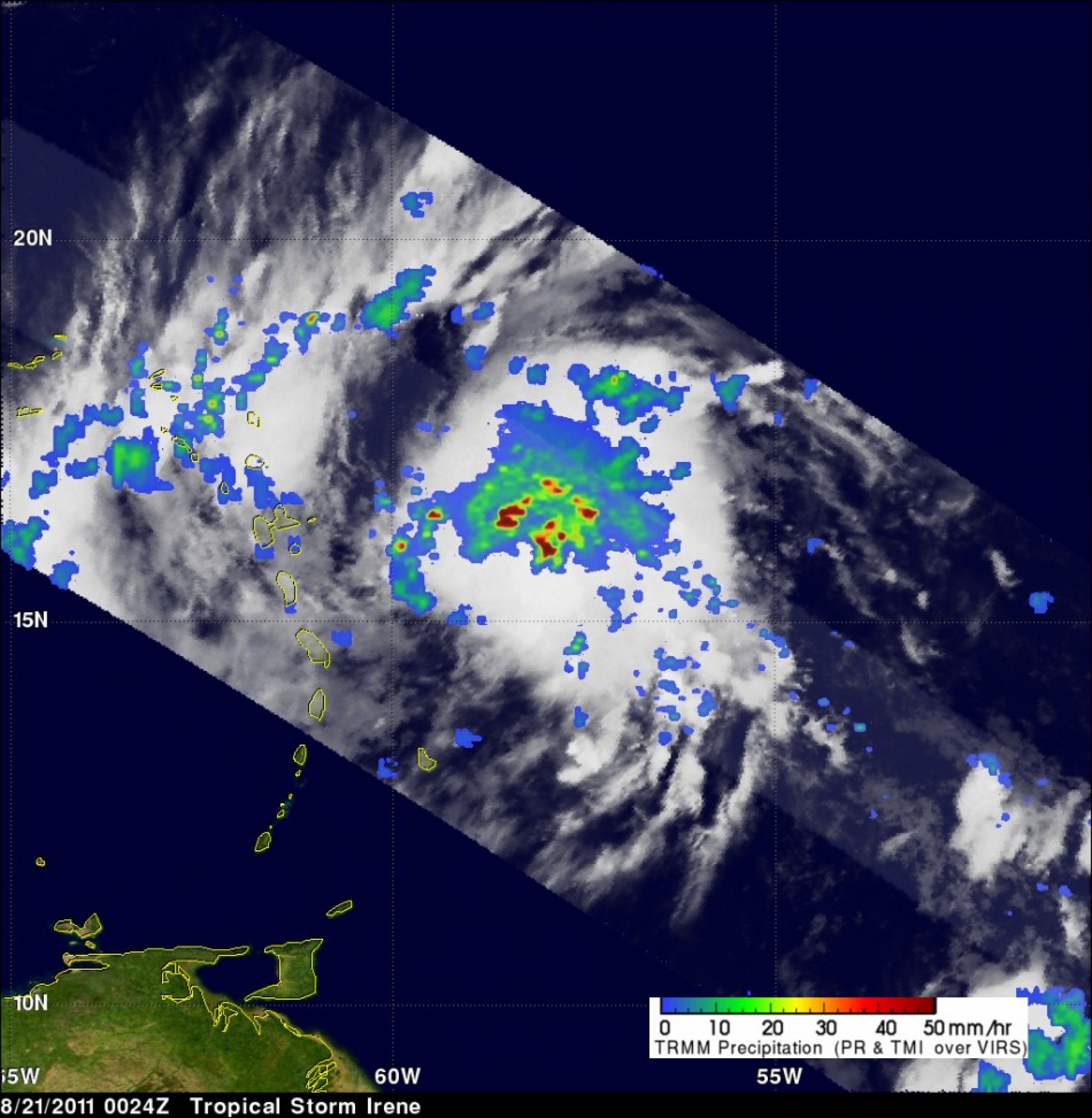
NASA's Tropical Rainfall Measuring Mission satellite passed over Irene when it was a tropical storm on Aug. 21 at 0024 UTC (8:24 p.m. EDT Aug. 20). With the satellite's precipitation radar, the data showed how some thunderstorm towers near the center of the storm were reaching to heights above 15 kilometers, or about 9.3 miles. This is called a hot tower, mainly because they rise to such altitude due to the large amount of latent heat.
This hot tower showed NASA researchers that something greater was amiss with Irene. NASA researchers Owen Kelley and John Stout of NASA's Goddard Space Flight Center, Greenbelt, Md. found a tropical cyclone with a hot tower in its eyewall was twice as likely to intensify into a hurricane.
Today alone, Irene is expected to produce total rainfall accumulations of five to 10 inches across Puerto Rico, The Virgin Islands, the Dominican Republic, Haiti, the Southeastern Bahamas and The Turks and Caicos Islands. Hurricane warnings are in effect for North Coast of the Dominican Republic from the Haiti border east to Cabo Engano as well as other parts of the Caribbean.
As Irene has just begun to approach Puerto Rico, it's far from finished. Forecasters are saying that by Thursday morning, Irene could reach Florida. It would the first landfalling hurricane in the mainland U.S. in three years since Hurricane Ike ravaged Texas in 2008.
The TRMM satellite passed over Irene when it was a tropical storm on Aug. 21 at 0024 UTC (8:24 p.m. EDT Aug. 20). Data collected with this orbit showed that Irene contained numerous powerful thunderstorms with TRMM's Precipitation Radar (PR) revealing that some thunderstorm towers near the center of the storm were reaching to heights above 15 km.
NASA/SSAI, Hal Pierce
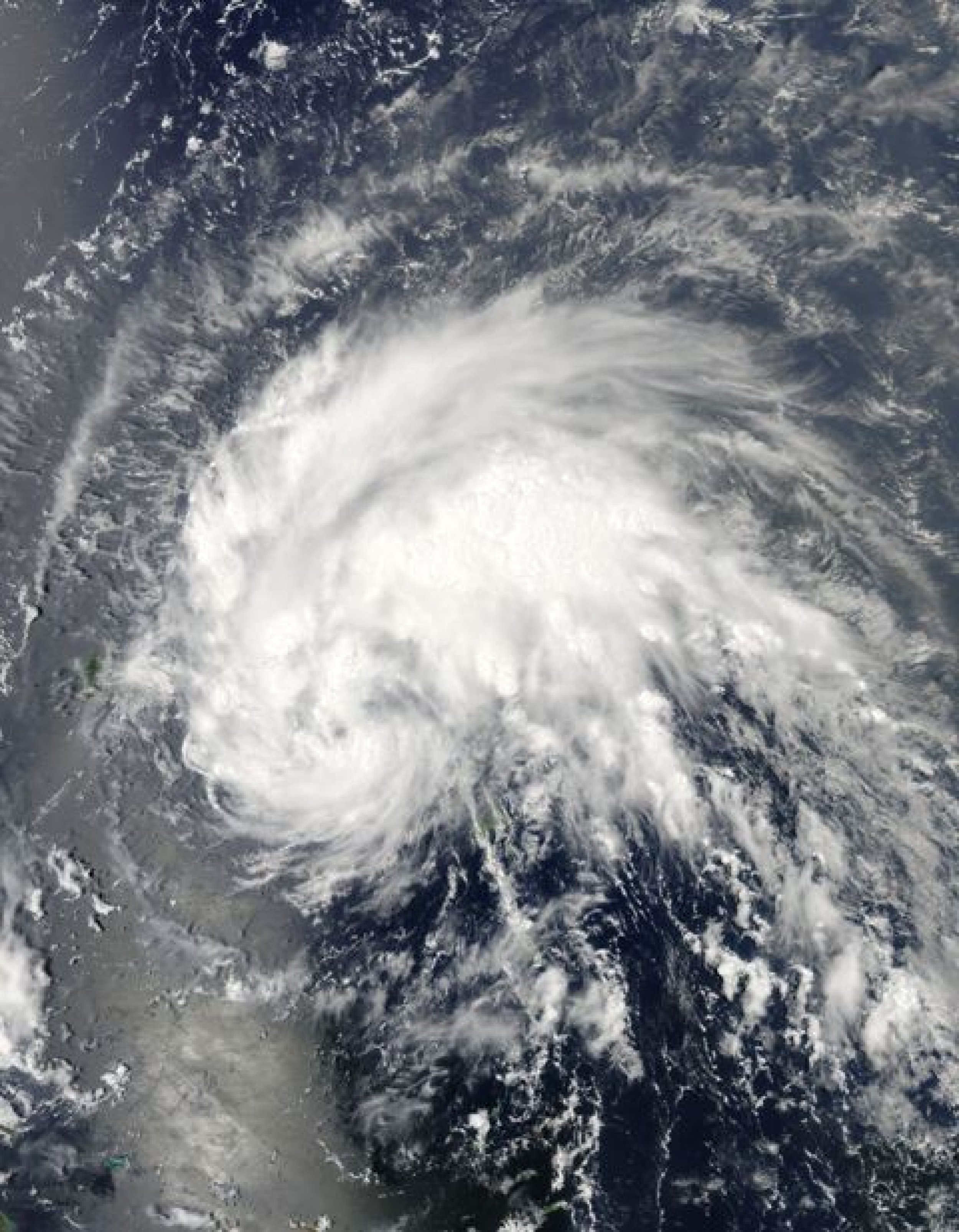
This visible image was taken from the MODIS instrument on NASA's Aqua satellite on Aug. 21, 2011 at 17:45 UTC (1:45 p.m. EDT) when Irene was still a tropical storm approaching Puerto Rico (left).
NASA Goddard MODIS Rapid Response Team
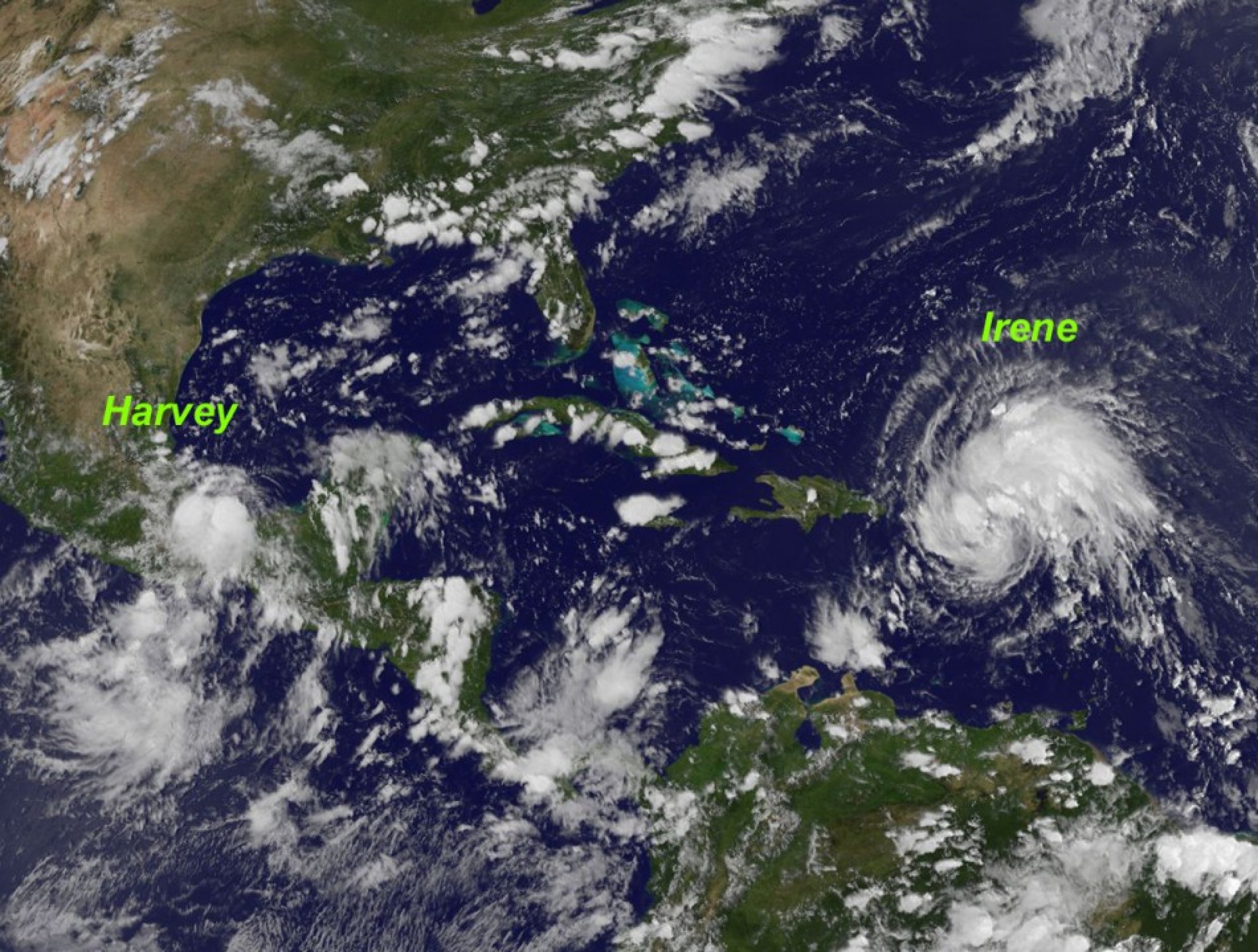
The GOES-13 satellite also tracked Irene and watched as it went from Tropical Storm Irene over Puerto Rico on Sunday, Aug. 21, at 6 p.m to Hurricane Irene.
A GOES-13 animation from Aug. 19 through Aug. 22 (1545 UTC/11: 45 a.m. EDT) shows the progression of Tropical Storm Harvey through the western Caribbean Sea and the birth of Hurricane Irene.
Credit: NASA


© Copyright IBTimes 2024. All rights reserved.


