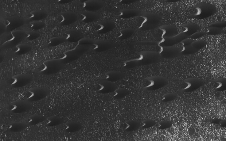
Mars Reconnaissance Orbiter Image Reveals Sand Dunes On Red Planet

Mars is a sandy place. So it is to be expected that the planet's russet terrain would be littered with numerous sand dunes, shaped and eroded by powerful winds blowing over millions of years.
One of the larger population of Martian sand dunes exists in the planet's southern hemisphere, near the Hellas impact basin — one of Mars' largest and most recognizable impact basin. On Friday, NASA released an image of a clump of dark, crescent-shaped dune formations located both within the region's craters and in the plains.
The images were captured using the High Resolution Imaging Science Experiment (HiRISE) camera on board the space agency's Mars Reconnaissance Orbiter (MRO).
"Here, the steep, sunlit side of the dune, called a slip face, indicates the down-wind side of the dune and direction of its migration. Other long, narrow linear dunes known as "seif" dunes are also here and in other locales to the east," NASA said in a statement accompanying the image.
The dunes seen in the image are primarily "barchan" dunes, which are crescent-shaped structures produced by action of wind from one direction. On Earth, these structures are widespread in open, inland desert regions.
The MRO has been orbiting the red planet since 2006, and has beamed back striking photos of Mars to Earth every month. Last August, NASA published its largest dump of images captured by the MRO’s HiRise camera, releasing a cache of over 1,000 photos that show the Martian surface in all its glory — from dunes and craters to mountains and ice caps.
All the photos in the image dump were taken in May, when Mars experienced its equinox — a period during a planet’s orbit when the sun shines directly on its equator, lighting up both its poles. Coincidentally, as Alfred McEwen, the director of the Planetary Image Research Laboratory, explained to Popular Science at the time, the equinox overlapped with the period when Mars and the sun were on the opposite sides of Earth — a phenomenon that facilitates unobstructed communication between the MRO and ground control.
As a result, the satellite was able to send a hefty amount of data in a short period of time.
The entire collection of images captured so far by the HiRise camera can be viewed here.
© Copyright IBTimes 2024. All rights reserved.


