

New Year Weather: California Braces For 'Potent' Weekend Storm; Flooding Likely

KEY POINTS
- Flooding in rivers, streams and creeks is possible through Sunday morning
- Northern Humboldt Coast could reach flood stage Saturday morning
- An Avalanche Watch has also been issued in the Greater Lake Tahoe area
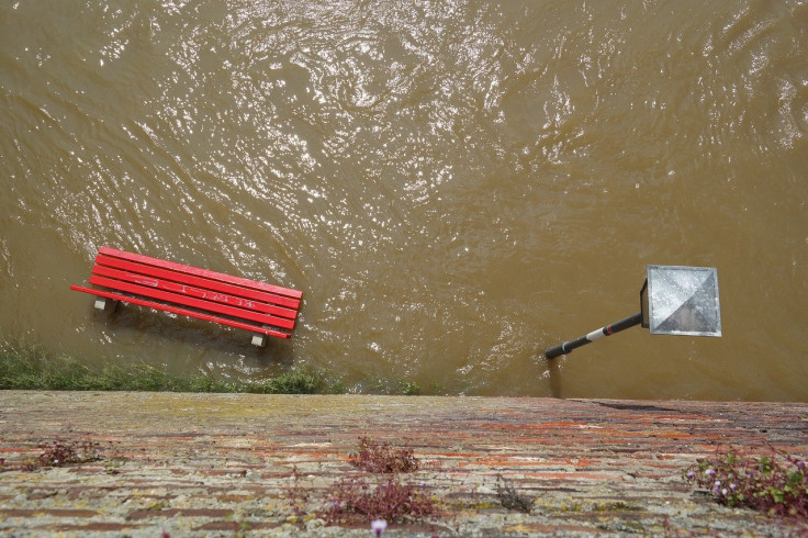
Flood-related alerts have been issued in parts of the western U.S., particularly in California, as the state and its neighbor Nevada brace for a "potent storm" that will last throughout the weekend.
"Heavy rain likely along with possible flooding for the West Coast of the U.S., with a focus from southwestern Oregon into central and northern California through the weekend," the National Weather Service (NWS) said in its Short Range Public Discussion report published Thursday.
In some affected areas, hourly rain totaling up to 3 inches locally "could lead to issues in area burn scars," the Weather Prediction Center (WPC) said.
Weather officials have particularly noted that the threat of heaviest rain and flooding could begin in southern California Saturday afternoon. In California's foothills, up to 8 inches of rain is possible, according to officials.
The NWS in Sacramento said heavy rainfall could trigger flooding in rivers, streams and creeks from Friday through Sunday morning.
The Flood Watch has been extended to cover most of interior #NorCal for Friday afternoon - early Sunday morning. Moderate to heavy rainfall may result in flooding of rivers, creeks, streams, and flood-prone areas. Be aware & prepared if you live near these areas! #CAwx pic.twitter.com/Nck9nJka6q
— NWS Sacramento (@NWSSacramento) December 29, 2022
The NWS in Eureka also noted that the Russian River near Hopland "is expected to reach 15 feet for flood stage on Saturday." Minor flooding is possible for croplands, officials said.
Russian River near Hopland is expected to reach 15 feet for flood stage on Saturday. At 15 feet flooding of Highway 175 is expected at the approaches to the Russian River bridge. Expect minor flooding of crop land on the west bank of the river. #cawx pic.twitter.com/I1dCOxDsI2
— NWS Eureka (@NWSEureka) December 30, 2022
While many portions of the state could get up to 4 inches of rain, including Laytonville, Gravelly Valley Airport, Willits, Orleans, Hoopa and Gasquet, some areas such as Ruth and Shelter Cove have been forecasted to see up to 6 inches of rainfall.
Here are the updated rainfall totals through Saturday. The rain will be mainly steady starting Thursday night, but there may be a couple breaks. A flood watch remains in effect for much of the area. Visit https://t.co/puxKJFy7J6 for details. pic.twitter.com/9w5db21dGz
— NWS Eureka (@NWSEureka) December 29, 2022
Parts of California's border with Nevada have also been placed under Flood Watches as officials continue to monitor the Greater Lake Tahoe area and the Sierras.
A Flood Watch is in effect from Friday AM-Sat PM for northeast CA, Lake Tahoe, the Sierra Nevada, and western NV. Excessive runoff from heavy rainfall may result in flooding of main stem rivers, creeks, streams, and other low-lying and flood-prone areas. https://t.co/Kvn360goh7 pic.twitter.com/MCxqOp2rqE
— NWS Reno (@NWSReno) December 28, 2022
There are currently no rain-related alerts in Oregon, but officials did note that the latest forecast makes the Oregon-California border "looking awfully colorful."
That Oregon-California border do be looking awfully colorful 🤕 https://t.co/reiZXJBvLM
— NWS Medford (@NWSMedford) December 29, 2022
The latest NWS forecast map shows that mixed precipitation of heavy snow, heavy rain and flash flooding could affect a small portion of the Oregon-California border sometime Friday.
Alerts in California
Flood Watch effective through late Saturday:
- Bakersfield, Buttonwillow – Lost Hills – I5, Buena Vista, Coalinga – Avenal, Caruthers – San Joaquin – Selma, Fresno – Clovis, Los Banos – Dos Palos, Delano – Wasco – Shafter, Fresno – Tulare Foothills, Hanford – Corcoran – Lemoore, Mariposa Madera Foothills, Merced – Madera – Mendota, South End Sierra Foothills, South End San Joaquin Valley, West Side Mountains South of 198, West Side Mountains North of 198, Visalia – Porterville – Reedley, West Side of Fresno and Kings Counties
Flood Watches effective through 5 p.m. Saturday:
- Southern Mendocino Interior (flood stage of 15 feet forecasted to be reached late Saturday morning)
- Mendocino Coast, Southern Trinity, Northern Lake and Southwestern Mendocino Interior
Flood Watches effective from Friday afternoon through 4 a.m. Sunday:
- Sonoma Coastal Range, North Bay Interior Mountains, Coastal North Bay, Marin Coastal Range, North Bay Interior Valleys, Point Reyes National Seashore
- East Bay Hills, East Bay Interior Valleys, Eastern Santa Clara Hills, National Monument, Northern and Southern Monterey Bay, Big Sur Coast, Northern and Southern Salinas Valley, Carmel Valley, Hollister Valley, San Francisco Bay Shoreline, Pinnacles, Santa Cruz Mountains, Santa Clara Valley, Los Padres National Forest, Lake San Antonio, Arroyo Seco, Santa Lucia Mountains and San Francisco Peninsula Coast
- Yosemite Valley and San Joaquin River Canyon
- Northern Humboldt Coast (flood stage of 20 feet forecasted to be reached late Saturday morning)
Avalanche Watch effective through 7 a.m. Sunday:
- Central Sierra Nevada Mountains between Yuba Pass on the north and Ebbetts Pass on the south
Alerts in Nevada
Flood Watches effective through late Saturday night:
- Lassen – Eastern Plumas – Eastern Sierra Counties, Surprise Valley and Mono County, Northern Washoe County
- Martin Creek, Quinn River and McDermitt Creek
Avalanche Watch effective through 7 a.m. Sunday:
- Greater Lake Tahoe Area
© Copyright IBTimes 2024. All rights reserved.
- MOST POPULAR IN National


