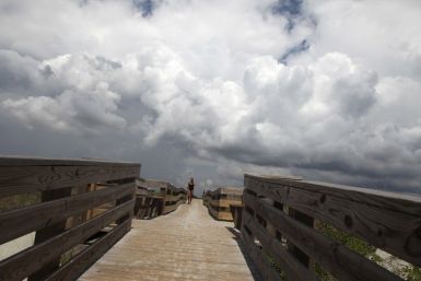
Hurricane Irene battered the low-lying Bahamas southeast of Florida on Thursday and now churns toward U.S. East Coast -- posing extreme danger to some of the country's largest cities.
Fugitive strongman Muammar Gaddafi taunted his Libyan enemies and their Western backers from his hiding place as NATO targeted his hometown and rebels announced a move to govern the country from Tripoli.
Hurricane Irene which is approaching the East coast would have an impact not only on the coastal regions but also on the inland, U.S. officials warned on Thursday.
New Yorkers living in coastal areas are being warned to prepare for evacuation as Hurricane Irene seemingly heads straight for them. The exact path of the storm remains unclear, but meteorologists are increasingly predicting nothing short of a catastrophe for New York City.
Preparations begin for the hurricane.
In a bid to get ahead of Hurricane Irene that threatens to thrash the U.S. East Coast, New York declares a state of emergency, becoming the fifth state to do so.
Hurricane Irene has caused the indefinite postponement of the dedication of the Martin Luther King Jr. Memorial that was slated for Sunday.
A strengthening Hurricane Irene continues to move towards the U.S. East Coast, destroying some islands in the Bahamas along its path as it heads for the big cities. New York is the latest of five states to declare a state of emergency.
Hurricane Irene is gearing up to be the biggest storm threatening to hit the New York metropolitan area in 26 years. Should Irene make landfall on Sunday with hurricane strength, it will be one of about five storms that have come within 75 miles of the city, according to data dating to 1851.
Category 3 Hurricane Irene is gaining momentum and seemingly heading right for the city that never sleeps, and the potential exists -- in addition to risks to human life -- for major damage to New York's dwellings/infrastructure and economy.
Irene is expected to pass through Western Mass. Sunday night into Monday
Hurricane Irene continued its path of destruction towards the East Coast on Thursday -- posing extreme danger to some of the country's largest cities.
New Yorkers are preparing for Hurricane Irene, which threatens to become one of the biggest storms to hit the metropolitan area in decades. If Irene makes landfall in the New York area at hurricane strength, the powerful storm would be one of about five hurricanes to come within 75 miles of the city, according to records dating back 160 years.
Hurricane Irene poses an extraordinary threat to virtually upper half of the U.S. East Coast, threatening to become a storm of a lifetime. The major Category 3 storm has the potential to further strengthen before making landfall, and major metropolitan areas from Norfolk to New York and Boston face a threat of rare storm potency.
Hurricane Irene is expected to reach parts of Eastern Canada over the weekend.
As Hurricane Irene batters the northern Bahamas on as it heads toward the East Coast on Thursday, train services were canceled and workers scrambled to protect power lines in the U.S. capital, Washington D.C.
The death of the renowned left-handed baseball pitcher, Mike Flanagan has been ruled as suicide resulting from a self-inflicted gunshot.
Hurricane Irene is shaping up to be the U.S. east coast storm of a lifetime. Officials say Irene poses an extreme threat to areas from North Carolina to to southern New England through the end of the weekend. The major Category 3 storm has the potential to further strengthen before making landfall, and major metropolitan areas from Norfolk to New York and Boston face a threat of rare storm potency.
While no one can know ahead of time just how much destruction a Category 3 Hurricane like Irene will do, specialty companies that specialize in catastrophic risk analysis are armed with historical data as well as links to national computer centers that track the storm in real time.
As Hurricane Irene approaches the East Coast, Airlines began issuing travel waivers and cancelling flights.
Gathering strength as she morphs into a major Category 4 storm, Hurricane Irene continues her assault threat on the East Coast. But even she can't slow preparations for NASA's upcoming launches from Florida's Space Coast, including a moon-studying mission slated to start Sept. 8, the space agency said.
Gold prices fought off an early drop to post modest gains Thursday as investors thought better of the yellow metal's value as a safe haven.


