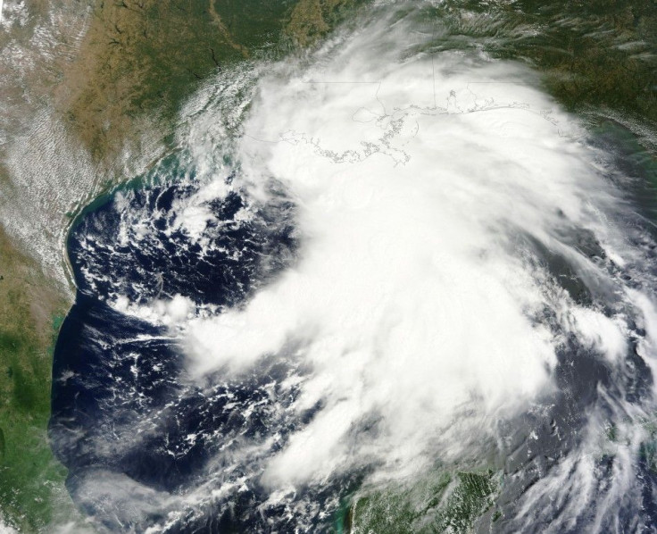
Tropical Storm Lee Hits Louisiana Coast

Tropical Storm Lee barreled into southern Louisiana's coast on Sunday, as New Orleans prepared for one of the biggest tests of its flood defenses since Hurricane Katrina devastated the city in 2005.
The National Hurricane Center said Lee's center was about 80 miles west of Morgan City, Louisiana, with maximum sustained winds of 45 mph at around 5 a.m. EDT.
Winds were expected to weaken gradually in the next couple of days and up to 20 inches of rain was expected to fall on southeast Louisiana, the Miami-based center said.
In New Orleans, about 70 miles east of Morgan City, the storm recalled Hurricane Katrina, which flooded 80 percent of the city, killed 1,500 people and caused more than $80 billion in damage to the popular tourist destination.
Half the city lies below sea level and is protected by a system of levees and flood gates.
The levees can process about one inch of rainfall per hour and the storm's slow-moving nature remained a worry, officials said. There were isolated reports of flooding in roads and homes.
Don't go to sleep on this storm, Mayor Mitch Landrieu told residents. He said stormy conditions could continue for the next 36 hours.
New Orleans is under a flash flood watch through Monday night, the National Weather Service said. Potential damage from wind gusts will also be a concern, it said.
No injuries or fatalities were reported in Louisiana, but rough waters off Galveston Island in Texas led to the drowning death of a 34-year-old man, an island official said.
TIDAL SURGE
Lee's tidal surge could spur coastal flooding in Louisiana, Mississippi and Alabama before drenching a large swath of the southeast and Appalachian regions next week.
Storm winds were already pushing Gulf waters inland, slamming barriers in low-lying areas and prompting mandatory evacuations in the coastal communities of Lafitte, Crown Point and Barataria.
In Mississippi, local governments were taking precautions as forecasters predicted tides could be 2 feet to 4 feet above normal.
About 8,000 houses were without electrical power due to the storm, down from about 35,000 earlier on Saturday, according to utility Entergy Corp..
Over 60 percent of U.S. offshore oil production, all based in the Gulf of Mexico, and nearly 55 percent of offshore gas production were shut as of Friday, according to the U.S. government. Most of that output should quickly return once the storm passes.
Major offshore producers like Royal Dutch Shell, Exxon Mobil Corp and BP Plc shut down platforms and evacuated staff earlier this week.
Shell and Anadarko Petroleum Corp started to return workers to offshore platforms in the western Gulf of Mexico on Saturday.
Low-lying refineries in Louisiana that collectively account for 12 percent of U.S. refining capacity were watching the storm closely, but reported no disruptions.
ConocoPhillips' 247,000 barrel-per-day refinery in Alliance, Louisiana, 25 miles south of New Orleans, was operating normally as Lee moved overhead, the company said.
In the open Atlantic, Hurricane Katia weakened to a tropical storm on Saturday and was forecast to wobble back and forth between hurricane and tropical storm strength far from land, the hurricane center said.
© Copyright Thomson Reuters 2024. All rights reserved.


