What Makes Cyclone Freddy An Exceptional Storm

Cyclone Freddy, which has twice smashed into the African coast after traversing the Indian Ocean, may be enshrined in the history books as the longest ever documented, meteorologists say.
A factfile:
The storm began to brew in early February in the southeastern Indian Ocean off northern Australia, whose weather service gave it the designation of Freddy on February 6.
Freddy then crossed the entire ocean, brushing past Mauritius and the French island of La Reunion, before making landfall in Madagascar on February 21 and sweeping over the island before reaching Mozambique on February 24.
It claimed nearly two dozen lives in both countries and affected nearly 400,000 people.
The storm then went back out to sea, refuelling on the warm waters of the southwest Indian Ocean, before doing the rare manoeuvre of reversing course to head back to Africa.
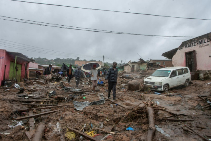
Last weekend it hit Mozambique again with wind gusts of up to 200 kilometres per hour (125 mph) before ravaging the landlocked country of Malawi, triggering floods and mudslides that have killed more than 200 people.
The French weather service Meteo-France describes Freddy as a "particularly powerful and compact tropical system, generating extreme winds near its core".
In a bulletin released at 0600 GMT on Wednesday, Malawi's ministry of natural resources and climate change said Freddy had "diffused," and extreme rain associated with the storm would fall back.
It has travelled more than 8,000 kilometres (5,000 miles). The last cyclones to cross the entire southern Indian Ocean were Leon-Eline and Hudah in 2000.
"Tropical Cyclone Freddy is exceptional mainly due to the fact that it has lasted longer than any other in historical records," says Melissa Lazenby, a lecturer in climate change at the University of Sussex in southern England.
Last week it unofficially broke the World Meteorological Organization's benchmark as the longest-lasting tropical cyclone on record, set in 1994 for a 31-day storm named John.
A panel of WMO experts in extreme weather events will now study whether Freddy is the new titleholder, a process likely to take months.
On March 3, the US National Aeronautics and Space Administration (NASA) said Freddy set the record for having the highest accumulated cyclone energy -- the total amount of energy associated with a tropical cyclone over its lifetime -- of any southern hemisphere storm in history.
Major storms in the Indian Ocean are known as cyclones, as typhoons in the Pacific and hurricanes in the Atlantic.
Experts are cautious about whether Freddy can be specifically linked to climate change, a phenomenon that is measured over the long term rather than on single events, but say it is consistent with predictions.
"Based on the IPCC report, this type of extreme tropical cyclone event is not surprising due to previous predictions that cyclones will become more intense," said Lazenby, referring to the UN's Intergovernmental Panel on Climate Change.
"More analysis would need to be done to deduce the reasoning behind its... longevity," she said.
"In general, climate change is contributing to making tropical cyclones stronger and wetter and increasing the risk of coastal flooding from storm surge due to sea-level rise," said Allison Wing, associate professor at Florida State University.
Scientists have not detected any long-term trend in the number of tropical cyclones, she said.
However, "there is evidence that tropical cyclones are getting more intense, and especially that the strongest storms are getting stronger," said Wing.
A recently observed phenomenon in past years has been a tendency of big storms to swiftly ramp up a gear, strengthening by at least 35 miles (56 kilometres) per hour over just 24 hours, she added.
© Copyright AFP 2024. All rights reserved.


